White River, Mpumalanga
| White River Witrivier | |
|---|---|
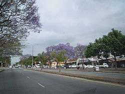 A street in White River | |
 White River  White River White River (South Africa)  White River White River (Africa) | |
| Coordinates: 25°19′S 31°01′E / 25.317°S 31.017°ECoordinates: 25°19′S 31°01′E / 25.317°S 31.017°E | |
| Country | South Africa |
| Province | Mpumalanga |
| District | Ehlanzeni |
| Municipality | Mbombela |
| Area[1] | |
| • Total | 60.55 km2 (23.38 sq mi) |
| Population (2011)[1] | |
| • Total | 16,639 |
| • Density | 270/km2 (710/sq mi) |
| Racial makeup (2011)[1] | |
| • Black African | 32.5% |
| • Coloured | 4.3% |
| • Indian/Asian | 2.5% |
| • White | 60.3% |
| • Other | 0.4% |
| First languages (2011)[1] | |
| • Afrikaans | 42.2% |
| • English | 28.7% |
| • Swazi | 16.1% |
| • Tsonga | 3.0% |
| • Other | 10.0% |
| Time zone | UTC+2 (SAST) |
| Postal code (street) | 1240 |
| PO box | 1240 |
White River (Afrikaans: Witrivier) is a small holiday and farming town situated just north of Nelspruit in Mpumalanga, South Africa. The farms in the region produce tropical fruits, vegetables, flowers and timber.
Origin
After the Boer War the British demarcated land on the Emanzimhlope River, a tributary of the Crocodile River. Emanzimhlope translates from the Swazi as 'White Waters'.
Lord Milner (administrator of the defeated Transvaal) tasked his attache, Tom Lawrence, to demarcate land on the 'Emanzimhlope' – a tributary of the Crocodile River – to demobilised British Anglo-Boer War soldiers. The longest street in town is still named after Lawrence, who was the first manager of the new settlement.
The farming tradition of the community that settled here after the Anglo-Boer War has remained virtually unchanged to this day. After a 26 km canal to channel water from the river was built, the new settlers planted fruit trees and established new cultivation methods.
Agriculture
The agriculture involves largely the production of tropical fruits, vegetables, flowers and timber and tobacco, and is one of the most fertile in the province.
White River, with three irrigation dams and a number of nearby forests, is a popular holiday destination for those looking to visit the Crocodile River Valley, and the town has a reputation for its arts and crafts. One of the attractions for the art scene is Casterbridge Lifestyle Center situated on the outskirts of the city. Once a mango plantation it now sports a cinema, art exhibitions in its various art galleries, theater plays, concerts, a vintage motor museum and various restaurants.[2] Within the town is the Hoërskool Rob Ferreira High School.
Region
White River lies 20 km north of Nelspruit not far from the border with Kruger National Park. White River has a population of 16,639[1] and is located in an area of considerable scenic beauty. Compared to other parts of South Africa, the climate is neither excessively hot in summer when rainfall is at its highest, nor overly cold during the sunny winters. The farms tend to be relatively small but the agriculture is intensive with tropical and citrus fruits in abundance, and vegetables and cut flowers readily available.
| Climate Data for Nelspruit | ||||||||||||
|---|---|---|---|---|---|---|---|---|---|---|---|---|
| Month | Jan | Feb | Mar | Apr | May | Jun | Jul | Aug | Sep | Oct | Nov | Dec |
| Average high °C (°F) | 27.5 (81.5) | 27.4 (81.3) | 26.5 (79.7) | 25.2 (77.4) | 23.4 (74.1) | 21.7 (71.1) | 21.1 (70.0) | 23.1 (73.6) | 24.7 (76.5) | 26.1 (79.0) | 26.3 (79.3) | 27.0 (80.6) |
| Average low °C (°F) | 17.0 (62.6) | 16.9 (62.4) | 15.8 (60.4) | 13.6 (56.5) | 9.6 (49.3) | 7.1 (44.8) | 6.6 (43.9) | 8.6 (47.5) | 11.0 (51.8) | 13.7 (56.7) | 15.2 (59.4) | 16.4 (61.5) |
| Average precipitation mm (inches) | 171 (6.7) | 156 (6.1) | 124 (4.9) | 57 (2.2) | 24 (0.9) | 13 (0.5) | 15 (0.6) | 14 (0.5) | 37 (1.5) | 77 (3.0) | 130 (5.12) | 150 (5.9) |
White River is 46 km from Hazyview, one of the easiest access points to the world-famous Kruger National Park.
References
- 1 2 3 4 5 "Main Place White River". Census 2011.
- ↑ Casterbridge. "Casterbridge Lifestyle Centre. Shopping, restaurants, hotel, cinema and art in White River". casterbridge.co.za. Archived from the original on 29 April 2016. Retrieved 9 May 2016.
- ↑ "Climate: White River – Climate graph, Temperature graph, Climate table – Climate-Data.org". en.climate-data.org. Archived from the original on 12 May 2016. Retrieved 9 May 2016.
Municipalities and communities of Ehlanzeni District Municipality, Mpumalanga | ||
|---|---|---|
District seat: Mbombela | ||
| Mbombela | .svg.png) | |
| Nkomazi | ||
| Thaba Chweu | ||
| Umjindi | ||
| Bushbuckridge | ||