Swalala
| Swalala | |
|---|---|
 Swalala  Swalala Swalala (South Africa)  Swalala Swalala (Africa) | |
| Coordinates: 25°10′59″S 31°07′01″E / 25.183°S 31.117°ECoordinates: 25°10′59″S 31°07′01″E / 25.183°S 31.117°E | |
| Country | South Africa |
| Province | Mpumalanga |
| District | Ehlanzeni |
| Municipality | Mbombela |
| Government | |
| • Type | Ward 07 |
| Area[1] | |
| • Total | 4.19 km2 (1.62 sq mi) |
| Population (2011)[1] | |
| • Total | 7,954 |
| • Density | 1,900/km2 (4,900/sq mi) |
| Racial makeup (2011)[1] | |
| • Black African | 99.0% |
| • Coloured | 0.4% |
| • Indian/Asian | 0.1% |
| • White | 0.1% |
| • Other | 0.4% |
| First languages (2011)[1] | |
| • Swazi | 92.3% |
| • Sotho | 2.1% |
| • Other | 5.6% |
| Time zone | UTC+2 (SAST) |
| PO box | 1254 |
| Area code | 013 |
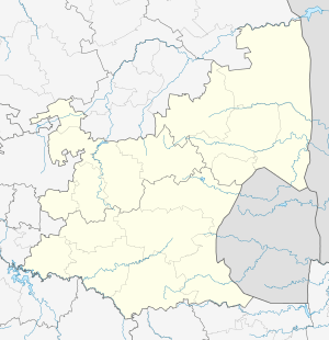
Swalala is a rural settlement in Mbombela Local Municipality in Ehlanzeni District of the Mpumalanga province, South Africa.
During the national census of 2011 it was estimated that the 4.19 km2 village house almost 8,000 inhabitants, of which 99% were Black South Africans with 92% speaking Seswati as their home language.[1]
References
This article is issued from
Wikipedia.
The text is licensed under Creative Commons - Attribution - Sharealike.
Additional terms may apply for the media files.
.svg.png)