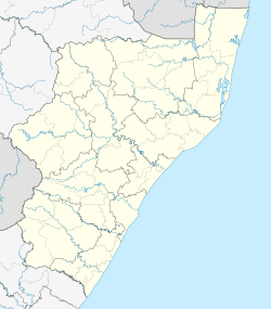
Weza, KwaZulu-Natal
| Weza | |
|---|---|
 Weza  Weza Weza (South Africa)  Weza Weza (Africa) | |
| Coordinates: 30°35′31″S 29°44′46″E / 30.592°S 29.746°ECoordinates: 30°35′31″S 29°44′46″E / 30.592°S 29.746°E | |
| Country | South Africa |
| Province | KwaZulu-Natal |
| District | Ugu |
| Municipality | UMuziwabantu |
| Area[1] | |
| • Total | 2.03 km2 (0.78 sq mi) |
| Population (2011)[1] | |
| • Total | 646 |
| • Density | 320/km2 (820/sq mi) |
| Racial makeup (2011)[1] | |
| • Black African | 86.2% |
| • Coloured | 2.6% |
| • Indian/Asian | 2.6% |
| • White | 8.2% |
| • Other | 0.3% |
| First languages (2011)[1] | |
| • Xhosa | 39.8% |
| • Zulu | 35.6% |
| • English | 8.9% |
| • Afrikaans | 7.8% |
| • Other | 8.1% |
| Time zone | UTC+2 (SAST) |
| PO box | 4685 |
| Area code | 039 |
Weza is a settlement in Ugu District Municipality in the KwaZulu-Natal province of South Africa.
Village some 20 km west of Harding and 50 km east of Kokstad. It takes its name from the Weza River, a northern tributary of the Mtamvuna River. Of Zulu origin, the name is said to mean ‘to cause to cross over’.
The main business activity in Weza is the Hans Marensky saw mill that has been operational for more than 30years in the area. The Weza State forest close to town offers visitors a relaxing breakaway with lovely hiking trails and mountain biking trails. The forest is also home to the endangered Cape Parrot and other bird life making it a wonderful place for bird watching.[2]
References
- 1 2 3 4 "Main Place Weza". Census 2011.
- ↑ "Dictionary of Southern African Place Names (Public Domain)". Human Science Research Council. p. 473.
This article is issued from
Wikipedia.
The text is licensed under Creative Commons - Attribution - Sharealike.
Additional terms may apply for the media files.
.svg.png)