Westhay
| Westhay | |
|---|---|
 Northern end of Westhay | |
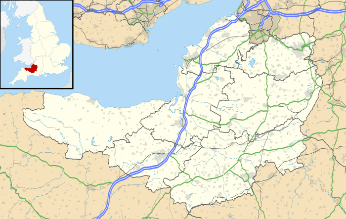 Westhay Westhay shown within Somerset | |
| OS grid reference | ST435425 |
| Civil parish | |
| District | |
| Shire county | |
| Region | |
| Country | England |
| Sovereign state | United Kingdom |
| Post town | GLASTONBURY |
| Postcode district | BA6 |
| Dialling code | 01458 |
| Police | Avon and Somerset |
| Fire | Devon and Somerset |
| Ambulance | South Western |
| EU Parliament | South West England |
| UK Parliament | |
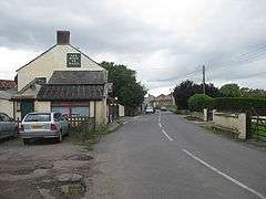
Westhay is a village in Somerset, England. It is situated in the parish of Meare, 4 miles (6.4 km) north west of Glastonbury on the Somerset Levels, in the Mendip district.
The name means 'The west field that is enclosed by hedges' from the Old English west and haga. The 'g' in haga is silent.[1]
Westhay is a marshland village on the River Brue in typical Somerset rhyne country, standing on the site of pre-historic lake dwellings. The site of the lake-village is marked by groups of mounds. Nearby was the Peat Moors Centre which closed down in the autumn of 2009. The prehistoric Sweet Track and Post Track run from the village southwards towards Shapwick.
The village is close to Westhay Moor and Westhay Heath, which have both been designated as Sites of Special Scientific Interest.
Westhay is serviced by one pub.

Westhay is well known as the site of the Starling Roost featured on many TV wildlife programmes. The roost is in National wildlife reserves such as Westhay Moor, Ham Wall and Shapwick Heath. The area also contains one third of the UK breeding population of Bitterns and the only known UK breeding populations of Great White Egret and Little Bittern.
References
| Wikimedia Commons has media related to Westhay. |