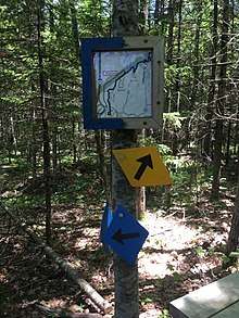
West Side Trail
| West Side Trail | |
|---|---|
| Length | 5.17 mi (8.3 km) |
| Location | Yarmouth, Maine |
| Trailheads | US 1, Yarmouth, Maine |
| Use | Walking, running, biking |
| Hiking details | |
The West Side Trail is a multi-use trail in Yarmouth, Maine. A Town of Yarmouth project conceived in 1988 and opened in 2014, its trailhead is in the parking lot of Tyler Technologies, on Tyler Drive, just off U.S. Route 1 (US 1) immediately before the on-ramp to Interstate 295 (I-295) northbound.
500 volunteer hours were put into the project, headed by Dan Ostrye of Yarmouth's town trail committee.[1] In 2010, Ostrye signed a lease agreement for the town with Central Maine Power so that the trail could be run through woods and meadows on Cousins Island and over the causeway to woods on CMP property on the mainland.[1]
The trail largely follows the overhead power lines originating from the Wyman Power Station, which is at the trail terminus near the southern tip of Cousins Island, 5.17 miles from the trailhead.
The first stretch rises northeast over a rocky bluff between US 1 and Route 88. When the trail returns to grade level, it crosses Route 88 (Lafayette Street) just a few feet north of Garrison Lane and continues southeast through the woods to a crossing at Gilman Road, which it traverses to the east of the Indian Fighters' burial ground. It then carries on to Princes Point Road. Drinkwater Point Road is the next crossing, before the trail emerges back onto Gilman Road just short of the Cousins Island (Snodgrass) Bridge. After crossing the bridge, the trail restarts at the northern end of the Sandy Point Beach parking lot. From here the trail crosses seven more, much quieter roads: Castle View Drive, Groves Road, Sea Meadows Lane, Tidewater Lane, Talbot Road (the sole outlet to Littlejohn Island), Shore View Drive and Wharf Road.
There are four areas where an alternative (and shorter) route is available. These are in the first section; the Gilman-to-Princes Point section; the Princes Point-to-Drinkwater Point section; and the Sandy Point Beach section.[2] Additionally, there are three side loops in the first section and one connector, to the southern section of the Fels-Groves Farm Preserve, in the Princes Point-to-Drinkwater Point section.[2]
A second phase is planned, which will extend the trail to the west of I-295, connecting major neighborhoods, including Oakwood, Applewood and the new (as of 2017) McKearney Village. A further plan is to connect to trails in North Yarmouth and Cumberland. Unlike the original phase, which was designed for single-track mountain biking and single-file walking or running, the second will allow for universal access, thanks to a five-foot-wide (1.5 m) gravel track.[3] An extension, from the exit 15 park and ride to West Elm Street, near its junction with Portland Street, is estimated to be opened in late 2017. This also follows the power lines.
Mileages
Distances measured by GPS; may differ from trail map (cumulative distances in parentheses).[2]
- Trailhead at Route 1
- 1.0 mile to Route 88
- 0.25 (1.25) miles to Gilman Road
- 0.49 (1.74) miles to Princes Point Road
- 0.17 (1.91) to Fels-Groves parking lot turnoff
- 0.36 (2.27) miles to Drinkwater Point Road
- 0.9 (3.17) miles to Sandy Point Beach
- 0.7 (3.87) miles, including crossings on Castle View Drive, Groves Road and Sea Meadows Lane
- 0.5 (4.37) miles, including crossings on Tidewater Lane and Talbot Road
- 0.6 (4.97) miles, including crossings on Shorewater View Drive and Wharf Road
- 0.2 (5.17) miles – forest loop back to Wharf Road
References
- 1 2 Fleming, Deirdre (August 31, 2014). "Yarmouth trail takes shape, recruits users". Portland Press Herald. Retrieved July 5, 2017.
- 1 2 3 Royal River Conservation Trust (July 2016). West Side Trail (Map). Scale not given. Cartography by Center for Community GIS. Royal River Conservation Trust. Retrieved July 5, 2017.
- ↑ Royal River Conservation Trust (n.d.). "West Side Trail". Royal River Conservation Trust. Retrieved July 5, 2017.
External links
- West Side Trail – Royal River Conservation Trust
- West Side Trail's Facebook page
- West Side Trail – NEMBA.org