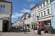
Wejherowo
| Wejherowo | |||
|---|---|---|---|
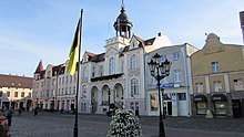
 City from a bird's eye view | |||
| |||
 Wejherowo | |||
| Coordinates: 54°36′N 18°15′E / 54.600°N 18.250°E | |||
| Country |
| ||
| Voivodeship | Pomeranian | ||
| County | Wejherowo County | ||
| Gmina | Wejherowo (urban gmina) | ||
| Established | 1643 | ||
| Town rights | 1650 | ||
| Government | |||
| • Mayor | Krzysztof Hildebrandt | ||
| Area | |||
| • City | 25.65 km2 (9.90 sq mi) | ||
| Highest elevation | 110 m (360 ft) | ||
| Lowest elevation | 24 m (79 ft) | ||
| Population (2012) | |||
| • City | 50,310 | ||
| • Density | 2,000/km2 (5,100/sq mi) | ||
| • Metro | 130,000 | ||
| Time zone | UTC+1 (CET) | ||
| • Summer (DST) | UTC+2 (CEST) | ||
| Postal code | 84-200 to 84-204 | ||
| Area code(s) | +48 58 | ||
| Car plates | GWE | ||
| Website | http://www.wejherowo.pl | ||

Wejherowo [vɛi̯xɛˈrɔvɔ] (Kashubian: Wejrowò, German: Neustadt in Westpreußen) is a city in Gdańsk Pomerania, northern Poland, with 50,310 inhabitants (2012). It has been the capital of Wejherowo County in Pomeranian Voivodeship since 1999; previously, it was a city in Gdańsk Voivodeship (1975–1998).
Geographical location
Wejherowo is located in Pomeralia, approximately 11 km (7 mi) west of the town of Rumia, 32 kilometres (20 miles) east of the town of Lębork and 35 km (22 mi) north-west of the regional metropole of Gdańsk, in the broad glacial valley of the river Rheda at an altitude of 30 metres (98 feet) above sea level.
History

Wejherowo was founded in 1643 as Wola Wejherowska (literally "Wejher's Wola"), by the voivode of the Malbork Voivodeship, and Polish noble, Jakub Wejher (Jakob Weiher). It was translated in the colloquial German of the time as Weihersfrey or Veyersfrey. According to the founder's will, the dwellers of the new settlement were to possess the same city rights as other towns in the region, hence the place granted Kulm law. The town's privileges, received in 1655, were confirmed by King John II Casimir Vasa of Poland on the Reichstag.
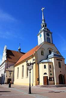
Wejher, who survived the Smolensk War, built two churches in the new settlement (The Holy Trinity and Saint Ann). He also brought in Franciscan fathers, built a monastery, and founded a calvary, consisting of 26 chapels, aligned along the border of the town forest, which were built during 1646–55. According to the founder's written statement of 1655, all honorable persons, independent of their nationality, were invited to become citizens of the new settlement if they would pay a citizen fee of ten gulden each.
In the First Partition of Poland in 1772, in which the Kingdom of Prussia annexed Pomerelia, the town was incorporated into the Kingdom, and administered within the new province of West Prussia. Its name in German changed from Weyersfrey to Neustadt in Westpreußen, a name which was in use also before. The affix "in West Prussia" was added to the town's name in order to avoid confusion with a number of other towns carrying the same name. Decisive factors which boosted the development of the town in the 19th century were the 1818 establishment of Landkreis Neustadt, an administrative district, and the construction of the Danzig (Gdańsk) – Stettin (Szczecin) railway line, to which Neustadt was connected with a train station in 1870. Neustadt became part of the German Empire in 1871 during the Prussian-led unification of Germany. During the second half of the 19th century, a significant number of Jewish families from the region began migrating to Syracuse, New York, including the renowned Shubert theatrical family. The Poles formed 59.3% of population in the district area of the city around this time.[1] The city itself, however, was predominantly German with a Polish minority of 5 % in 1890.[2]
In 1905 "Neustadt" had a Protestant church, two Catholic churches, a synagogue, a grammar school, a preparatory school for a training college for school teachers, a training college for evangelical school teachers, a mental asylum, a local court, a forest office, cigarette factories, sawmills, a brewery, a cattle trade and wood trade as well as grain trade.[3] During the Partitions the German authorities led a systemic campaign of Germanization against local the Polish and Kashubian populations, which resisted by organizing the secret patriotic organization Zwiazek Filomatow, distributing the Polish newspaper Gazeta Gdanska, and by establishing various local economic initiatives[4]
Until 1919 Neustadt belonged to the administrative district of Regierungsbezirk Danzig in the Province of West Prussia in Germany. After World War I the town was integrated into the Second Polish Republic. Wejherowo was the capital of Wejherowo County in Pomeranian Voivodeship, becoming a headquarters of state administration responsible for the maritime economy. After the invasion of Poland at the beginning World War II, Wejherowo was annexed by the Third Reich and became part of Regierungsbezirk Danzig in the province of Reichsgau Danzig-West Prussia.

Most of the town's Jewish community was murdered by the Nazis during the war, while many local Poles were also victims of the Nazi extermination policy.[4] The nearby village of Piaśnica Wielka was the site of a mass murder where about 12,000 Poles were shot in 1939. During World War II Neustadt was occupied by the Red Army. After the end of war, in 1945, Neustadt was placed under Polish administration under its Polish name Wejherowo.
Number of inhabitants by year
| Year | Number | Remarks |
|---|---|---|
| 1789 | 700 | |
| 1831 | 1,690 | [5] |
| 1845 | 1,800 | [6] |
| 1853 | 2,500 | [7] |
| 1865 | 3,200 | [8] |
| 1875 | 4,506 | [9] |
| 1880 | 4,715 | [9] |
| 1890 | 5,546 | incl. 2,336 Protestants, 3,039 Catholics and 160 Jews[10] (240 Poles[9]) |
| 1905 | 8,389 | incl. 3,044 Protestants, 5,171 Catholics, 26 other Christians and 148 Jews |
| 1921 | 8,786 | |
| 1943 | 16,490 | |
| 1948 | 13,400 | |
| 1960 | 24,500 | |
| 1970 | 33,800 | |
| 1980 | 42,400 | |
| 1990 | 46,800 | |
| 2000 | 46,200 | |
| 2006 | 47,159 | |
| 2011 | 49,922 |
Culture
- Museum of Kashubian and Pomeranian Writing and Music.
Education
- Kaszubsko-Pomorska Szkoła Wyższa
Notable people
- Kinga Baranowska (born 1975), mountaineer
- Jerzy Budnik (born 1951), politician
- Dorota Masłowska (born 1983), writer
- Marcin Miotk (born 1973), mountaineer
- Paul Gottlieb Nipkow (1860–1940), television pioneer
- Tomasz Pohl (born 1968), writer, poet
- Paul Peter Rhode (1871–1945), Roman Catholic bishop
- Henryk Szczepański (1933-2015), footballer
- Paweł Poljański (born 1990), professional cyclist
International relations
Twin towns — sister cities
Wejherowo is twinned with:
References
- ↑ Polski ruch narodowy w prusach zachodnich w latach: 1860-1914 Szczepan Wierzchosławski page 19 Zakład Narodowy im. Ossolińskich, 1980
- ↑ Handbuch der historischen Stätten, Ost und Westpreußen (Stuttgart 1981), p. 157.
- ↑ Meyers Konversations-Lexikon, 6th edition, Vol 14, Leipzig and Vienna 1908, p. 580, no. 21.
- 1 2 Wejherowo historia miasta
- ↑ August Eduard Preuß: Preußische Landes- und Volkskunde. Königsberg 1835, pp. 411–412, no. 27.
- ↑ Universal-Lexikon der Gegenwart und Vergangenheit (H. A. Pierer, ed.), 2nd edition, Vol. 19, Altenburg 1845, p. 407, no. 14.
- ↑ Conversations-Lexikon, 10th edition, Vol. 11, Brockhaus, Leipzig 1853, p. 163
- ↑ Meyer's Konversations-Lexikon, 2nd edition, Vol. 11, Hildburghausen 1865, p. 1085, no. 17.
- 1 2 3 Michael Rademacher: Deutsche Verwaltungsgeschichte Provinz Westpreußen, Kreis Neustadt (2006).
- ↑ Brockhaus' Konversations-Lexikon, 14th edition, Vol. 12, Berlin and Vienna 1894, p. 289, no. 32
External links
| Wikimedia Commons has media related to Wejherowo. |
- Official web page of Wejherowo (in English)
- Wejherowo homepage. "Throughout the centuries."
- wejher.com - news, photos, bulletin board (in Polish)
- Wejherowo Land
- Following the trail of manor houses and castles of the Northern Kashubian Region
- Northern Kashubia Heritage
Coordinates: 54°36′N 18°14′E / 54.600°N 18.233°E
| Urban gminas |  | |
|---|---|---|
| Rural gminas | ||