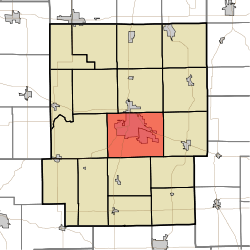
Wayne Township, Kosciusko County, Indiana
| Wayne Township | |
|---|---|
| Township | |
 | |
| Coordinates: 41°13′10″N 85°50′16″W / 41.21944°N 85.83778°WCoordinates: 41°13′10″N 85°50′16″W / 41.21944°N 85.83778°W | |
| Country | United States |
| State | Indiana |
| County | Kosciusko |
| Government | |
| • Type | Indiana township |
| Area | |
| • Total | 45.06 sq mi (116.7 km2) |
| • Land | 42.73 sq mi (110.7 km2) |
| • Water | 2.33 sq mi (6.0 km2) |
| Elevation[1] | 830 ft (253 m) |
| Population (2010) | |
| • Total | 27,551 |
| • Density | 644.7/sq mi (248.9/km2) |
| Time zone | UTC-5 (Eastern (EST)) |
| • Summer (DST) | UTC-4 (EDT) |
| FIPS code | 18-81782[2] |
| GNIS feature ID | 454034 |
Wayne Township is one of seventeen townships in Kosciusko County, Indiana. As of the 2010 census, its population was 27,551 and it contained 11,267 housing units.[3]
Wayne Township was organized in 1836.[4]
Geography
According to the 2010 census, the township has a total area of 45.06 square miles (116.7 km2), of which 42.73 square miles (110.7 km2) (or 94.83%) is land and 2.33 square miles (6.0 km2) (or 5.17%) is water.[3]
Cities and towns
Unincorporated towns
(This list is based on USGS data and may include former settlements.)
Education
Wayne Township residents may obtain a free library card from the Warsaw Community Public Library in Warsaw.[5]
References
- ↑ "US Board on Geographic Names". United States Geological Survey. 2007-10-25. Retrieved 2008-01-31.
- ↑ "American FactFinder". United States Census Bureau. Retrieved 2008-01-31.
- 1 2 "Population, Housing Units, Area, and Density: 2010 - County -- County Subdivision and Place -- 2010 Census Summary File 1". United States Census. Retrieved 2013-05-10.
- ↑ Biographical and Historical Record of Kosciusko County, Indiana. Lewis Publishing Company. 1887. p. 688.
- ↑ "Getting a Library Card". Warsaw Community Public Library. Retrieved 8 March 2018.
External links
Municipalities and communities of Kosciusko County, Indiana, United States | ||
|---|---|---|
| Cities | ||
| Towns | ||
| Townships | ||
| Unincorporated communities |
| |
| Footnotes | ‡This populated place also has portions in an adjacent county or counties | |
This article is issued from
Wikipedia.
The text is licensed under Creative Commons - Attribution - Sharealike.
Additional terms may apply for the media files.