Harrison Township, Kosciusko County, Indiana
| Harrison Township | |
|---|---|
| Township | |
 | |
| Coordinates: 41°12′54″N 85°58′51″W / 41.21500°N 85.98083°WCoordinates: 41°12′54″N 85°58′51″W / 41.21500°N 85.98083°W | |
| Country | United States |
| State | Indiana |
| County | Kosciusko |
| Government | |
| • Type | Indiana township |
| Area | |
| • Total | 42.92 sq mi (111.2 km2) |
| • Land | 41.7 sq mi (108 km2) |
| • Water | 1.22 sq mi (3.2 km2) |
| Elevation[1] | 804 ft (245 m) |
| Population (2010) | |
| • Total | 3,587 |
| • Density | 86/sq mi (33/km2) |
| Time zone | UTC-5 (Eastern (EST)) |
| • Summer (DST) | UTC-4 (EDT) |
| FIPS code | 18-31882[2] |
| GNIS feature ID | 453391 |
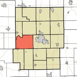
Harrison Township is one of seventeen townships in Kosciusko County, Indiana. As of the 2010 census, its population was 3,587 and it contained 1,538 housing units.[3]
Harrison Township was organized in 1838.[4]
Geography
According to the 2010 census, the township has a total area of 42.92 square miles (111.2 km2), of which 41.7 square miles (108 km2) (or 97.16%) is land and 1.22 square miles (3.2 km2) (or 2.84%) is water.[3]
Cities and towns
- Mentone (north side)
Unincorporated towns
(This list is based on USGS data and may include former settlements.)
Education
Harrison Township residents may obtain a free library card from the Bell Memorial Public Library in Mentone.[5]
References
- ↑ "US Board on Geographic Names". United States Geological Survey. 2007-10-25. Retrieved 2008-01-31.
- ↑ "American FactFinder". United States Census Bureau. Retrieved 2008-01-31.
- 1 2 "Population, Housing Units, Area, and Density: 2010 - County -- County Subdivision and Place -- 2010 Census Summary File 1". United States Census. Retrieved 2013-05-10.
- ↑ Biographical and Historical Record of Kosciusko County, Indiana. Lewis Publishing Company. 1887. p. 733.
- ↑ "How to get a library card". Bell Memorial Public Library. Retrieved 8 March 2018.
External links
Municipalities and communities of Kosciusko County, Indiana, United States | ||
|---|---|---|
| Cities | ||
| Towns | ||
| Townships | ||
| Unincorporated communities |
| |
| Footnotes | ‡This populated place also has portions in an adjacent county or counties | |
This article is issued from
Wikipedia.
The text is licensed under Creative Commons - Attribution - Sharealike.
Additional terms may apply for the media files.