Waupaca Municipal Airport
| Waupaca Municipal Airport Brunner Field | |||||||||||||||
|---|---|---|---|---|---|---|---|---|---|---|---|---|---|---|---|
 | |||||||||||||||
| Summary | |||||||||||||||
| Airport type | Public | ||||||||||||||
| Owner/Operator | City of Waupaca | ||||||||||||||
| Serves | Waupaca, Wisconsin | ||||||||||||||
| Elevation AMSL | 840 ft / 256 m | ||||||||||||||
| Coordinates | 44°20′0″N 089°1′11″W / 44.33333°N 89.01972°W | ||||||||||||||
| Website | CityOfWaupaca.org/... | ||||||||||||||
| Map | |||||||||||||||
 PCZ Location of airport in Wisconsin  PCZ PCZ (the US) | |||||||||||||||
| Runways | |||||||||||||||
| |||||||||||||||
| Statistics | |||||||||||||||
| |||||||||||||||
Waupaca Municipal Airport (ICAO: KPCZ, FAA LID: PCZ) is a city-owned public-use airport located three nautical miles (6 km) southeast of the central business district of Waupaca, a city in Waupaca County, Wisconsin, United States.[1] The airport is also known as Brunner Field.[3] It is located adjacent to U.S. Route 10. It is included in the Federal Aviation Administration (FAA) National Plan of Integrated Airport Systems for 2019–2023, in which it is categorized as a local general aviation facility.[4]
Although most U.S. airports use the same three-letter location identifier for the FAA and IATA, this airport is assigned PCZ by the FAA but has no designation from the IATA.[5]
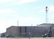
Facilities and aircraft
Waupaca Municipal Airport covers an area of 386 acres (156 ha)[1] at an elevation of 840 feet (256 m) above mean sea level.[2] It has two asphalt paved runways: 10/28 is 5,200 by 100 feet (1,585 x 30 m) with approved GPS approaches and 13/31 is 3,899 by 75 feet (1,188 x 23 m).[1]
Plane Guys Aviation, LLC. is the Fixed-Base Operator.
For the 12-month period ending September 14, 2016, the airport had 20,160 aircraft operations, an average of 55 per day: 99% general aviation, 1% air taxi and less than 1% military. In July 2018, there were 42 aircraft based at this airport: 33 single-engine, 2 multi-engine, 2 jet, 1 helicopter and 4 ultralights.[1]
Images
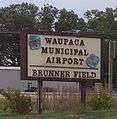 Entrance sign
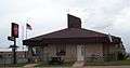 Terminal
See also
References
- 1 2 3 4 5 FAA Airport Master Record for PCZ (Form 5010 PDF), effective July 19, 2018.
- 1 2 Waupaca Municipal Airport at Wisconsin DOT Airport Directory
- 1 2 Waupaca Municipal Airport, official website
- ↑ "NPIAS Report 2019-2023 Appendix A" (PDF). Federal Aviation Administration. October 3, 2018. Retrieved October 12, 2018.
- ↑ Great Circle Mapper: KPCZ - Waupaca Municipal Airport - Waupaca, Wisconsin
External links
- FAA Terminal Procedures for PCZ, effective October 11, 2018
- Resources for this airport:
- FAA airport information for PCZ
- AirNav airport information for KPCZ
- FlightAware airport information and live flight tracker
- NOAA/NWS latest weather observations
- SkyVector aeronautical chart, Terminal Procedures
Civil aviation in Wisconsin | ||
|---|---|---|
| Primary airports | ||
| Airlines | ||
| Aviation related | ||
| People | ||