Waukeenah, Florida
| Waukeenah, Florida | |
|---|---|
| Census-designated place | |
 Waukeenah  Waukeenah | |
| Coordinates: 30°24′41″N 83°57′12″W / 30.41139°N 83.95333°WCoordinates: 30°24′41″N 83°57′12″W / 30.41139°N 83.95333°W | |
| Country |
|
| State |
|
| County | Jefferson |
| Area[1] | |
| • Total | 3.22 sq mi (8.35 km2) |
| • Land | 3.16 sq mi (8.18 km2) |
| • Water | 0.07 sq mi (0.17 km2) |
| Elevation | 195 ft (59 m) |
| Population (2010) | |
| • Total | 272 |
| • Density | 86.1/sq mi (33.25/km2) |
| Time zone | UTC-5 (Eastern (EST)) |
| • Summer (DST) | UTC-4 (EDT) |
| Area code(s) | 850 |
| FIPS code | 12-75425[1] |
| GNIS feature ID | 0294191[2] |
Waukeenah is an unincorporated community and census-designated place (CDP) in Jefferson County, Florida, United States. As of the 2010 census the population was 272.[1]
Geography
Waukeenah is located at 30°24′40″N 83°57′11″W / 30.4111°N 83.9531°W (30.4111, -83.9531),[3] near the intersection of US 27/State Road 20 and County Road 259. It is 11 miles (18 km) southwest of Monticello, the Jefferson county seat, and 20 miles (32 km) east of Tallahassee, the state capital.
Waukeenah was once a resting point for travelers using the Old St. Augustine road, which started in St. Augustine and went to Pensacola, Florida.
According to the U.S. Census Bureau, the Waukeenah CDP has a total area of 3.2 square miles (8.4 km2), of which 3.2 square miles (8.2 km2) are land and 0.1 square miles (0.2 km2), or 2.04%, are water.[1]
References
- 1 2 3 4 "Geographic Identifiers: 2010 Census Summary File 1 (G001): Waukeenah CDP, Florida". American Factfinder. U.S. Census Bureau. Retrieved May 1, 2018.
- ↑ U.S. Geological Survey Geographic Names Information System: Waukeenah, Florida
- ↑ "US Gazetteer files: 2010, 2000, and 1990". United States Census Bureau. 2011-02-12. Retrieved 2011-04-23.
Municipalities and communities of Jefferson County, Florida, United States | ||
|---|---|---|
| City | 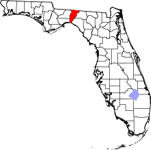 | |
| CDPs | ||
| Unincorporated communities | ||
| Ghost towns | ||
| Plantations | ||
| Footnote |
| |