Aucilla, Florida
| Aucilla, Florida | |
|---|---|
| Census-designated place | |
 Aucilla  Aucilla | |
| Coordinates: 30°28′52″N 83°45′13″W / 30.48111°N 83.75361°WCoordinates: 30°28′52″N 83°45′13″W / 30.48111°N 83.75361°W | |
| Country |
|
| State |
|
| County | Jefferson |
| Area[1] | |
| • Total | 2.00 sq mi (5.19 km2) |
| • Land | 2.00 sq mi (5.19 km2) |
| • Water | 0.00 sq mi (0.00 km2) |
| Elevation | 102 ft (31 m) |
| Population (2010) | |
| • Total | 100 |
| • Density | 49.9/sq mi (19.26/km2) |
| Time zone | UTC-5 (Eastern (EST)) |
| • Summer (DST) | UTC-4 (EDT) |
| Area code(s) | 850 |
| FIPS code | 12-02575[1] |
| GNIS feature ID | 0277993[2] |
Aucilla is an unincorporated community and census-designated place (CDP) in Jefferson County, Florida, United States, located near the intersection of county roads 158 and 257. As of the 2010 census the population was 100.[1]
Geography
Aucilla is located in eastern Jefferson County at 30°29'N 83°45′W (30.480,-83.754).[3] It is 1.5 miles (2.4 km) south of U.S. Route 90 and 1.8 miles (2.9 km) north of Interstate 10 at that highway's Exit 233. Aucilla is 9 miles (14 km) southeast of Monticello, the Jefferson county seat, via US-90, and 34 miles (55 km) east of Tallahassee, the state capital, via I-10.
According to the U.S. Census Bureau, the Aucilla CDP has an area of 2.0 square miles (5.2 km2), all of it recorded as land.[1]
Demographics
| Historical population | |||
|---|---|---|---|
| Census | Pop. | %± | |
| U.S. Decennial Census[4] | |||
References
- 1 2 3 4 "Geographic Identifiers: 2010 Census Summary File 1 (G001): Aucilla CDP, Florida". American Factfinder. U.S. Census Bureau. Retrieved April 30, 2018.
- ↑ U.S. Geological Survey Geographic Names Information System: Aucilla, Florida
- ↑ "US Gazetteer files: 2010, 2000, and 1990". United States Census Bureau. 2011-02-12. Retrieved 2011-04-23.
- ↑ "Census of Population and Housing". Census.gov. Retrieved June 4, 2016.
Municipalities and communities of Jefferson County, Florida, United States | ||
|---|---|---|
| City | 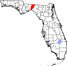 | |
| CDPs | ||
| Unincorporated communities | ||
| Ghost towns | ||
| Plantations | ||
| Footnote |
| |
This article is issued from
Wikipedia.
The text is licensed under Creative Commons - Attribution - Sharealike.
Additional terms may apply for the media files.