Washington Island Airport
| Washington Island Airport | |||||||||||||||
|---|---|---|---|---|---|---|---|---|---|---|---|---|---|---|---|
 | |||||||||||||||
| Summary | |||||||||||||||
| Airport type | Public | ||||||||||||||
| Owner/Operator | Town of Washington | ||||||||||||||
| Serves | Washington Island, Wisconsin | ||||||||||||||
| Elevation AMSL | 652 ft / 199 m | ||||||||||||||
| Coordinates | 45°23′13″N 086°55′30″W / 45.38694°N 86.92500°WCoordinates: 45°23′13″N 086°55′30″W / 45.38694°N 86.92500°W | ||||||||||||||
| Map | |||||||||||||||
 2P2 Location of airport in Wisconsin  2P2 2P2 (the US) | |||||||||||||||
| Runways | |||||||||||||||
| |||||||||||||||
| Statistics | |||||||||||||||
| |||||||||||||||
Washington Island Airport (FAA LID: 2P2) is a town owned public use airport located on Washington Island, in the Town of Washington, Door County, Wisconsin, United States.[1] It is included in the Federal Aviation Administration (FAA) National Plan of Integrated Airport Systems for 2019–2023, in which it is categorized as a basic general aviation facility.[2]
Facilities and aircraft
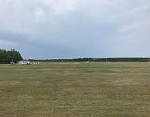
Washington Island Airport covers an area of 113 acres (46 ha) at an elevation of 652 feet (199 m) above mean sea level. It has two runways with turf surfaces: 2/20 is 2,250 by 150 feet (686 x 46 m) and 14/32 is 2,232 by 150 feet (680 x 46 m).[1]
For the 12-month period ending September 20, 2017, the airport had 6,030 aircraft operations, an average of 17 per day: 99% general aviation and less than 1% military. In June 2018, there were 7 aircraft based at this airport: all 7 single-engine.[1]
References
- 1 2 3 4 FAA Airport Master Record for 2P2 (Form 5010 PDF). Federal Aviation Administration. effective June 21, 2018.
- ↑ "NPIAS Report 2019-2023 Appendix A" (PDF). Federal Aviation Administration. October 3, 2018. Retrieved October 12, 2018.
External links
- "Washington Island (2P2)" (PDF). at Wisconsin DOT Airport Directory
- Resources for this airport:
- FAA airport information for 2P2
- AirNav airport information for 2P2
- FlightAware airport information and live flight tracker
- SkyVector aeronautical chart for 2P2
Civil aviation in Wisconsin | ||
|---|---|---|
| Primary airports | ||
| Airlines | ||
| Aviation related | ||
| People | ||