Washington Avenue Historic District (Philadelphia)
|
Washington Avenue Historic District | |
 1135 and 1201 Washington | |
   | |
| Location | Roughly bounded by Carpenter, Washington, 10th, and Broad Sts., Philadelphia, Pennsylvania |
|---|---|
| Coordinates | 39°56′17″N 75°9′44″W / 39.93806°N 75.16222°WCoordinates: 39°56′17″N 75°9′44″W / 39.93806°N 75.16222°W |
| Area | 16 acres (6.5 ha) |
| Built | 1889 |
| Architect | Multiple |
| NRHP reference # | 84003561[1] |
| Added to NRHP | September 7, 1984 |
| Location | Philadelphia |
|---|---|
| West end | Grays Ferry Avenue in South Philadelphia |
| Major junctions |
Front Street in South Philadelphia |
| East end | Columbus Boulevard in South Philadelphia |
Washington Avenue Historic District is a national historic district located in the Hawthorne neighborhood of South Philadelphia, Pennsylvania. It encompasses eight contributing buildings built between 1889 and 1927. They are large industrial buildings that were occupied by the Main Belting Company, John Williams Company and C. J. Milne textile manufacturers, John Wanamaker clothing factory, Curtis Publishing, American Cigar Company, John Wyeth Laboratories, and National Licorice.[2]
It was added to the National Register of Historic Places in 1984.[1]
History
Washington Avenue was a district of manufacturing plants and factories that was also known as the "workshop of the world" up until mid 20th century (1950s). The avenue was home to the Curtis Publishing Company printing press, "... which printed Ladies Home Journal and Saturday Evening Post, and the locally renowned merchant John Wanamaker’s."
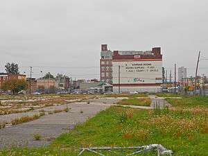 Empty lots at 1101 S. Broad and 1301 Washington where contributing buildings were located. 1201 Washington is in the background.
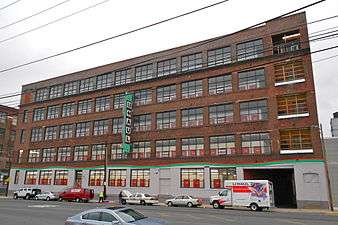 1135 Washington, formerly the American Cigar Company,
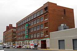
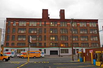 1201 Washington, formerly the John Wyeth Chemical Company,
Public transportation
The Washington Avenue Historic District is served by SEPTA's Route 64 bus.[3] Several other transit routes cross Washington Avenue, most important being the subsurface Broad Street Line with its station at Ellsworth-Federal.
References
- 1 2 National Park Service (2010-07-09). "National Register Information System". National Register of Historic Places. National Park Service.
- ↑ "National Historic Landmarks & National Register of Historic Places in Pennsylvania" (Searchable database). CRGIS: Cultural Resources Geographic Information System. Note: This includes George E. Thomas (March 1984). "National Register of Historic Places Registration Form: Washington Avenue Historic District" (PDF). Retrieved 2012-07-03.
- ↑ "SEPTA Route 64".
| Topics |   | |
|---|---|---|
| Lists by county |
| |
| Lists by city | ||
| Other lists | ||
| ||