Waring, Texas
| Waring, Texas | |
|---|---|
| Unincorporated community | |
.jpg) Old gas station in Waring, Texas | |
 Waring, Texas Location within the state of Texas  Waring, Texas Waring, Texas (the US) | |
| Coordinates: 29°57′3″N 98°48′11″W / 29.95083°N 98.80306°WCoordinates: 29°57′3″N 98°48′11″W / 29.95083°N 98.80306°W | |
| Country | United States |
| State | Texas |
| County | Kendall |
| Elevation | 1,345 ft (410 m) |
| Time zone | UTC-6 (Central (CST)) |
| • Summer (DST) | UTC-5 (CDT) |
| ZIP codes | 78074 |
| GNIS feature ID | 1349492 |
Waring is an unincorporated community in northwestern Kendall County, Texas, United States. It lies along local roads and the Guadalupe River, northwest of the city of Boerne, the county seat of Kendall County.[1] Its elevation is 1,345 feet (410 m).[2] Although Waring is unincorporated, it has a post office, with the ZIP code of 78074;[3] the ZCTA for ZIP Code 78074 had a population of 59 at the 2000 census.[4] The community is part of the San Antonio Metropolitan Statistical Area.
Founded in 1887 by R.P.M. Waring, the community was named for its founder's hometown of Waringford in Ireland; the name was not changed until 1901. From its foundation until service ceased in 1970, the community was a station on the Kerrville branch of the San Antonio and Aransas Pass Railway.[5]
Major Roads
- Waring Welfare Road
- Farm to Market Road 1621
Historical Population
| Historical population | |||
|---|---|---|---|
| Census | Pop. | %± | |
| 1890 | 100 | — | |
| 1900 | 150 | 50.0% | |
| 1910 | 200 | 33.3% | |
| 1920 | 300 | 50.0% | |
| 1930 | 284 | −5.3% | |
| 1950 | 80 | — | |
| 1990 | 73 | — | |
| 2000 | 59 | −19.2% | |
| 2010 | 73 | 23.7% | |
Gallery
.jpg) Waring School
Waring School.jpg) Waring Church
Waring Church.jpg) Office building
Office building
References
- ↑ Rand McNally. The Road Atlas '08. Chicago: Rand McNally, 2008, pp. 100-101.
- ↑ U.S. Geological Survey Geographic Names Information System: Waring, Texas
- ↑ Zip Code Lookup
- ↑ "American FactFinder". United States Census Bureau. Retrieved 2008-01-31.
- ↑ Waring, Texas, Handbook of Texas Online, 2008-01-11. Accessed 2008-09-26.
External links
Municipalities and communities of Kendall County, Texas, United States | ||
|---|---|---|
| Cities | 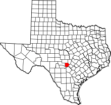 | |
| CDP | ||
| Unincorporated communities | ||
| Ghost towns | ||
| Footnotes | ‡This populated place also has portions in an adjacent county or counties | |