War Plan Red

| Country | Color |
|---|---|
| Canada | Crimson |
| Britain | Red |
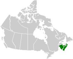
| Newfoundland | Red |
| India | Ruby |
| Australia | Scarlet |
| New Zealand | Garnet |
| Ireland | Emerald |
| The rest of the British Empire (not part of plan) | Pink |
Joint Army and Navy Basic War Plan Red was one of the color-coded war plans created by the United States Army in the late 1920s and early 1930s to estimate the requirements for a hypothetical war with the United Kingdom (the "Red" forces).[1] War Plan Red discussed the potential for fighting a war with the British Empire and outlined those steps necessary to defend the Atlantic coast against any attempted mainland invasion of the United States. It further discussed fighting a two-front war with both Japan and Britain simultaneously (as envisioned in War Plan Red-Orange).
War Plan Red was developed by the United States Army following the 1927 Geneva Naval Conference and approved in May 1930 by Secretary of War Patrick J. Hurley and Secretary of Navy Charles Francis Adams III and updated in 1934–35; it was not presented for presidential or Congressional approval. Only the United States Congress has the power to declare war.[2]
In 1939, on the outbreak of World War II, a decision was taken that no further planning was required but that the plan be retained.[3] War Plan Red was not declassified until 1974.
The war plan outlined those actions that would be necessary if for any reason the U.S. and Britain went to war with each other. The plan assumed that the British would initially have the upper hand by virtue of the strength of the Royal Navy. The plan further assumed that Britain would probably use its base in Canada as a springboard from which to initiate an invasion of the United States. The assumption was taken that at first Britain would fight a defensive battle against invading American forces, but that the U.S. would eventually defeat the British by blockading Britain and cutting off its food supplies.[4]
History
War Plan Red was one of a number of color-coded war plans developed by the U.S. after the First World War.
When War Plan Red was declassified in 1974, it caused a stir in American–Canadian relations because Canada, codenamed "Crimson" in the plan, was to have been the principal target of American forces.[2]
Outline
War Plan Red first set out a description of Canada's geography, military resources, and transportation, and went on to evaluate a series of possible pre-emptive American campaigns to invade Canada in several areas and occupy key ports and railways before British troops could provide reinforcement to the Canadians—the assumption being that Britain would use Canada as a staging point. The idea was that the American attacks on Canada would prevent Britain from using Canadian resources, ports, or airbases.[2]
A key move was a joint U.S. Army-Navy attack to capture the port city of Halifax, cutting off the Canadians from their British allies. Their next objective was to "seize Canadian Power Plants near Niagara Falls."[5] This was to be followed by a full-scale invasion on three fronts: From Vermont to take Montreal and Quebec, from North Dakota to take over the railhead at Winnipeg, and from the Midwest to capture the strategic nickel mines of Ontario. In parallel, the U.S. Navy was to seize the Great Lakes and blockade Canada's Atlantic and Pacific ports.[2]
Zones of operation
The main zones of operation discussed in the plan are:
- Nova Scotia and New Brunswick:
- Occupying Halifax, following a poison gas first strike, would deny the British a major naval base and cut links between Britain and Canada.
- The plan considers several land and sea options for the attack and concludes that a landing at St. Margarets Bay, a then undeveloped bay near Halifax, would be superior to a direct assault via the longer overland route.
- Failing to take Halifax, the U.S. could occupy New Brunswick by land to cut Nova Scotia off from the rest of Canada at the key railway junction in Moncton.
- Quebec and the valley of the Saint Lawrence River:
- Occupying Montreal and Quebec City would cut the remainder of Canada off from the Eastern seaboard, preventing the movement of troops and resources in both directions.
- The routes from northern New York to Montreal and from Vermont to Quebec are both found satisfactory for an offensive, with Quebec being the more critical target.
- Ontario and the Great Lakes area:
- Occupying this region gains control of Toronto and most of Canada's industry, while also preventing Britain and Canada from using it for air or land attacks against the U.S. industrial heartland in the Midwest.
- The plan proposes simultaneous offensives from Buffalo across the Niagara River, from Detroit into Windsor, and from Sault Ste. Marie into Sudbury. Controlling the Great Lakes for U.S. transport is considered logistically necessary for a continued invasion.
- Winnipeg
- Winnipeg is a central nexus of the Canadian rail system for connecting the country.
- The plan sees no major obstacles to an offensive from Grand Forks, North Dakota, to Winnipeg.
- Vancouver and Victoria:
- Although Vancouver's distance from Europe reduces its importance, occupying it would deny Britain a naval base and cut Canada off from the Pacific Ocean.
- Vancouver could be easily attacked overland from Bellingham, Washington, and Vancouver Island could be attacked by sea from Port Angeles, Washington.
- The British Columbia port Prince Rupert has a rail connection to the rest of Canada, but a naval blockade is viewed as easy if Vancouver were taken.
No attacks outside Western Hemisphere
Unlike the Rainbow Five plan, War Plan Red did not envision striking outside the Western Hemisphere. Its authors saw conquering Canada as the best way to attack the British Empire and believed that doing so would cause Britain to negotiate for peace. A problem with the plan was that it did not discuss how to attack the Empire if Canada declared its neutrality, which the authors believed was likely (the plan advised against accepting such a declaration without permission to occupy Canadian ports and some land until the war ended).[6]
Based on extensive war games conducted at the Naval War College, the plan rejected attacking British shipping or attempting to destroy the British fleet. The main American fleet would instead stay in the western North Atlantic to block British–Canadian traffic. The navy would wait for a good opportunity to engage the British fleet, and if successful would then attack British trade and colonies in the Western Hemisphere.[6]
In 1935, War Plan Red was updated and specified which roads to use in the invasion. "The best practicable route to Vancouver is via Route 99".[5] Further, in 1935, the Americans planned to build three military airfields near the Canada–US border and disguise them as civilian airports. "In February 1935, the War Department arranged a Congressional appropriation of $57 million to build three border air bases for the purposes of pre-emptive surprise attacks on Canadian air fields" (Berlin Glasnost, 1992–2007). The airfields were to be kept secret, but their existence was accidentally published by the Government Printing Office and reported on the front page of the New York Times on May 1, 1935.
The American planners had no thoughts of returning captured British territory: "The policy will be to prepare the provinces and territories of CRIMSON and RED to become states and territories of the BLUE union upon the declaration of peace."[5]
British strategy for war against the United States
The Royal Navy never prepared a formal plan for war with the United States during the first half of the 20th century. The government of David Lloyd George in 1919 restricted the navy from doing so to prevent it from using American naval growth to justify building more ships. Like their American counterparts, most Royal Navy officers viewed cooperation with the other nation as the best way to maintain world peace due to the shared culture, language, and goals, although the British feared that attempts to regulate trade during a war with another nation might force a war with the United States.[6]
Royal Navy officers generally believed that if war did occur, they could transport an army to Canada if asked, but nonetheless saw it as impossible to defend Canada against the much larger United States, so did not plan to do so, as Canada's loss would not be fatal to Britain. A full invasion of the United States was unrealistic and a naval blockade would be too slow. The navy could not use a defensive strategy of waiting for the American fleet to cross the Atlantic because Imperial trade would be left too vulnerable. The Royal Navy officers believed that Britain was vulnerable to a supply blockade and that if a superior American fleet appeared near the British Isles, the Isles would quickly surrender. The officers planned to, instead, attack the American fleet from a Western Hemisphere base, likely Bermuda, while other ships based in Canada and the West Indies would attack American shipping and protect Imperial trade. The navy would also bombard coastal bases and make small amphibious assaults. India and Australia would help capture Manila to prevent American attacks on British trade in Asia and perhaps a conquest of Hong Kong. The officers hoped that such acts would result in a stalemate making continued war unpopular in the United States, followed by a negotiated peace.[6]
Canadian counterpart
Canadian military officer Lieutenant Colonel James "Buster" Sutherland Brown developed an earlier counterpart to War Plan Red called Defense Scheme No. 1 on April 12, 1921. Maintaining that the best defense was a good offense, "Buster" Brown planned for rapid deployment of flying columns to occupy Seattle, Great Falls, Minneapolis, and Albany. With little hope of holding these objectives, the actual idea was to divert American troops to the flanks and away from Canada, hopefully long enough for Imperial allies to arrive with reinforcements. Defense Scheme No. 1 was terminated by Chief of the General Staff Andrew McNaughton in 1928, two years prior to the approval of War Plan Red.
See also
- Rainbow War Plans (1927–35)
- Trent Affair (1861)
- Pig War (1859)
- Aroostook War (1838–1839)
- War of 1812
References
- ↑ Roberts, Ken. Command Decisions. Center of Military History, Department of the Army. Retrieved July 19, 2011.
- 1 2 3 4 John Major, "War Plan Red: The American Plan for War with Britain," Historian (1998) 58#1 pp 12–15.
- ↑ June 15, 1939: Declassified Letter "Joint board to Secretary of Navy"
- ↑ Joint Estimate of the Situation – Red and Tentative Plan – Red (PDF). Security Classified Correspondence of the Joint Army-Navy Board, compiled 1918 – 03/1942, documenting the period 1910 – 3/1942. Joint Board, 325. Serial 274. Retrieved December 3, 2011.
- 1 2 3 Carlson, Peter (December 30, 2005). "Raiding the Icebox". Washington Post. Retrieved March 1, 2017.
- 1 2 3 4 Bell, Christopher M. (November 1997). "Thinking the Unthinkable: British and American Naval Strategies for an Anglo-American War, 1918-1931". The International History Review. 19 (4): 789–808. doi:10.1080/07075332.1997.9640804. JSTOR 40108144.
Further reading
- Bell, Christopher M., “Thinking the Unthinkable: British and American Naval Strategies for an Anglo-American War, 1918-1931”, International History Review, (November 1997) 19#4, 789–808.
- Holt, Thaddeus, "Joint Plan Red", in MHQ: The Quarterly Journal of Military History, Vol. 1 no. 1.
- Major, John. "War Plan Red: The American Plan for War with Britain," Historian (1998) 58#1 pp 12–15.
- Preston, Richard A. The Defence of the Undefended Border: Planning for War in North America 1867–1939. Montreal and London: McGill-Queen's University Press, 1977.
- Rudmin, Floyd W. Bordering on Aggression: Evidence of U.S. Military Preparations Against Canada. (1993). Voyageur Publishing. ISBN 0-921842-09-0
External links
| Wikisource has original text related to this article: |
- Rudmin, F. A 1935 US Plan for Invasion of Canada February 1995
- A Western Front Films Production in association with Brightside Films for Channel 5 America's Planned War On Britain: Revealed
- The Straight Dope Did the U.S. plan an invasion of Canada in the 1920s? February 2003