Waquoit Historic District
|
Waquoit Historic District | |
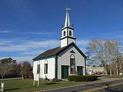 Waquoit Congregational Church | |
   | |
| Location | Falmouth, Massachusetts |
|---|---|
| Coordinates | 41°35′8″N 70°31′11″W / 41.58556°N 70.51972°WCoordinates: 41°35′8″N 70°31′11″W / 41.58556°N 70.51972°W |
| Area | 170 acres (69 ha) |
| Architect | Willard, Gilbert; et al. |
| Architectural style | Greek Revival |
| NRHP reference # | [1] |
| Added to NRHP | February 26, 2004 |
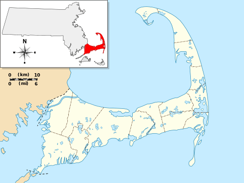
The Waquoit Historic District encompasses the historic village center of Waquoit, a village of Falmouth, Massachusetts. Waquoit Village is located in southeastern Falmouth at the head of Waquoit Bay. The district extends along the Waquoit Highway (Massachusetts Route 28) between Childs River Road and Red Brook Road, excluding the section between Parsons Lane and Carriage Shop Road. The latter two roads run through the village center, and the district includes many properties lining those roads as well. The 170-acre (69 ha) district includes 81 predominantly residential properties;[2] it was listed on the National Register of Historic Places in 2004.[1]
See also
References
- 1 2 National Park Service (2008-04-15). "National Register Information System". National Register of Historic Places. National Park Service.
- ↑ "NRHP nomination for Waquoit Historic District". Commonwealth of Massachusetts. Retrieved 2014-05-09.
| Topics |  | ||||||||||||||||
|---|---|---|---|---|---|---|---|---|---|---|---|---|---|---|---|---|---|
| Lists by county | |||||||||||||||||
| Lists by city |
| ||||||||||||||||
| Other lists | |||||||||||||||||
| |||||||||||||||||
This article is issued from
Wikipedia.
The text is licensed under Creative Commons - Attribution - Sharealike.
Additional terms may apply for the media files.