Wami River
| Wami River | |
| River | |
 | |
| Country | Tanzania |
|---|---|
| Tributaries | |
| - left | Mkata |
| - right | Lukigura; Mjonga; Chogoati |
| Cities | Dakawa, Gama, Tanzania |
| Mouth | |
| - location | at Saadani in the Indian Ocean, Tanzania |
| - elevation | 0 m (0 ft) |
| - coordinates | 6°7′S 38°49′E / 6.117°S 38.817°ECoordinates: 6°7′S 38°49′E / 6.117°S 38.817°E |
| Basin | 43,946 km2 (16,968 sq mi) |
| Discharge | |
| - average | 60.6 m3/s (2,140 cu ft/s) |
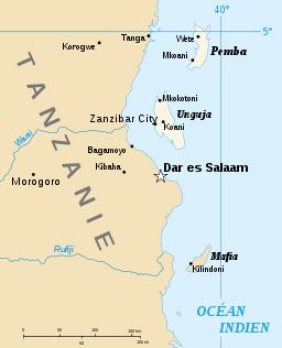 | |
The Wami River lies entirely within Tanzania in the Pwani Region and Morogoro Region in eastern Tanzania. Its source is specified in the Kaguru Mountains and it flows East entering the Indian Ocean west of Zanzibar. But its catchment area extends from the Kinyasangwe River to far beyond Dodoma to the southern edge of the Maasai Steppe and is denoted with 43,946 km².[1] Only after leaving the Mkata River basin on the northern edge of the Mikumi National Park is its name Wami.[2] Due to deforestation and climatic changes in the region the runoff decreased.[3] Wami river is the southern border of the Saadani National Park, the only coastal National Park in Tanzania.
Hydrometry
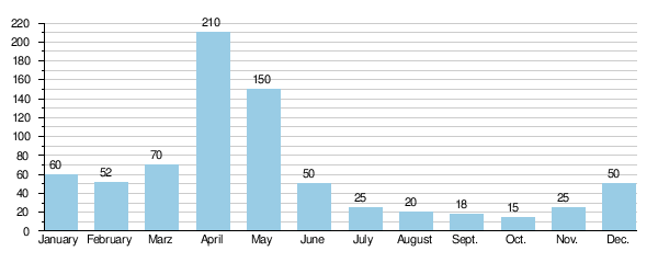
The river flow observed over 30 years (1954–84) in Mandera a town about 50 km above the mouth. The at Mandera observed average annual flow during this period was 60.6 m³ / s fed by an area of about 82% of the total catchment area of the River.
The average monthly flow of the river Wami hydrological station of Mandera (in m³ / s )
(Calculated using the data for a period of 30 years, 1954–84)[4]
Gallery
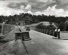 Opening of Mandera Bridge
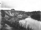 Wami River between 1906 and 1918 at Kissanke
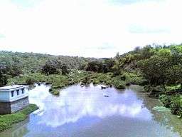
 2012
2012