Wambrook, New South Wales
| Wambrook New South Wales | |||||||||||||||
|---|---|---|---|---|---|---|---|---|---|---|---|---|---|---|---|
 | |||||||||||||||
|
Wambrook Location in New South Wales | |||||||||||||||
| Coordinates | 36°12′37″S 148°57′02″E / 36.21028°S 148.95056°ECoordinates: 36°12′37″S 148°57′02″E / 36.21028°S 148.95056°E | ||||||||||||||
| Population | 44 (2016 census)[1] | ||||||||||||||
| Postcode(s) | 2630 | ||||||||||||||
| Location | |||||||||||||||
| LGA(s) | Snowy Monaro Regional Council | ||||||||||||||
| Region | Monaro | ||||||||||||||
| County | Wallace | ||||||||||||||
| Parish | Wambrook | ||||||||||||||
| State electorate(s) | Monaro | ||||||||||||||
| Federal Division(s) | Eden-Monaro | ||||||||||||||
| |||||||||||||||
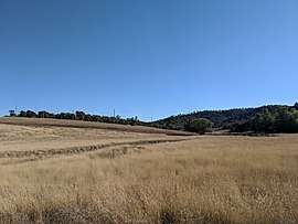
Wambrook is a locality in the Snowy Monaro Region, New South Wales, Australia.[2][3] It it located in grasslands mainly to the northeast of the Snowy Mountains Highway, about 30 km southeast of Adaminaby and 25 km northwest of Cooma. It is about 140 km south of Canberra. At the 2016 census, it had a population of 44.[1]
It had a school from 1892 to 1903 and from 1912 to 1928, described as a "provisional" school until March 1916 and subsequently as a "half-time" school.[4]
References
- 1 2 Australian Bureau of Statistics (27 June 2017). "Wambrook". 2016 Census QuickStats. Retrieved 3 April 2018.

- ↑ "Wambrook". Geographical Names Register (GNR) of NSW. Geographical Names Board of New South Wales. Retrieved 3 April 2018.
- ↑ "Wambrook". OpenStreetMap. Retrieved 3 April 2018.
- ↑ "Wambrook school in the school history database search". New South Wales Department of Education. Retrieved 3 April 2018.
This article is issued from
Wikipedia.
The text is licensed under Creative Commons - Attribution - Sharealike.
Additional terms may apply for the media files.