Waldstein (mountain range)
| Waldstein | |
|---|---|
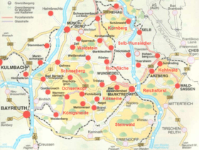 Location of the Waldstein in the Fichtel mountains | |
| Highest point | |
| Peak | Großer Waldstein |
| Elevation | 877 m above NN |
| Geography | |
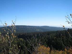
 The Fichtel mountains (Fichtelgebirge) in northeast Bavaria
| |
| State | Bavaria, Germany |
| Range coordinates | 50°07′44″N 11°51′18″E / 50.12889°N 11.855°ECoordinates: 50°07′44″N 11°51′18″E / 50.12889°N 11.855°E |
The Waldstein is a mountain range in the northern part of the Fichtel Mountains in Upper Franconia, Bavaria, in southern Germany.
Geography
Its highest elevation is the Großer Waldstein which is 877 metres (2,877 ft) high. In addition, the Epprechtstein, the Kleiner Waldstein and the ridge of the Hallerstein Forest, south of the town Hallerstein are all located in this mountain range. To the east the Großer Kornberg is the end of the mountain chain, while in the west it falls gently away at Gefrees.
Geology
Geologically the massif consists mainly of granite. The history of its orogeny begins in the Precambrian about 750–800 million years ago – almost 20% of the earth's history. Only a few of these mountain stump ranges (Rumpfgebirge) remain today.
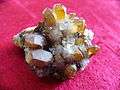 Crystal from the Waldstein
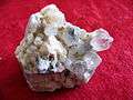 Mountain crystal or berg-crystal
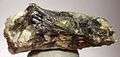
Language and settlement
The eastern part of the Waldstein ridge forms an approximate linguistic boundary between the East Franconian and Bavarian dialects, because settlement developed along the rivers rising in the Fichtelgebirge mountains: the Saale, White Main Eger and Fichtelnaab.
Structures
On the Großen Waldstein is the Großer Waldstein transmitter. On the Epprechtstein are the ruins of Epprechtstein Castle.
Maps
- Fritsch Wanderkarte 1:50,000 scale - Fichtelgebirge-Steinwald
Gallery
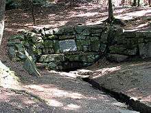 Source of the River Saale
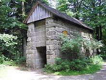 Bear trap in the Waldstein
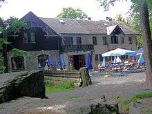 The Waldsteinhaus
External links
- Waldstein (in German)