Waka P'iqi
| Waka P'iqi | |
|---|---|
 Waka P'iqi Location within Bolivia | |
| Highest point | |
| Elevation | 4,578 m (15,020 ft) [1] |
| Coordinates | 16°54′45″S 66°38′11″W / 16.91250°S 66.63639°WCoordinates: 16°54′45″S 66°38′11″W / 16.91250°S 66.63639°W |
| Geography | |
| Location |
Bolivia, Cochabamba Department |
| Parent range | Andes |
Waka P'iqi (Aymara waka cow, p'iqi, p'iq'iña, phiq'i, phiq'iña head,[2][3][4] "cow head", also spelled Huaca Pekhe) is a 4,578-metre-high (15,020 ft) mountain in the Bolivian Andes. It is located in the Cochabamba Department, Ayopaya Province, Cocapata Municipality, west of the village of Chorito. Wak'a P'iqi lies at the left bank of the Jatun Mayu ("big river").[1][5]
References
- 1 2 Bolivia 1:100,000 Comunidad Chorito 3537, Map prepared and published by the Defense Mapping Agency, Hydrographic/Topographic Center, Bethesda, MD
- ↑ "Diccionario Quechua - Aymara al español". Retrieved April 17, 2016.
- ↑ "Diccionario Bilingüe, Castellano - Aymara, 2002". Félix Layme Pairumani. Retrieved April 17, 2016. (see: Cabeza)
- ↑ Radio San Gabriel, "Instituto Radiofonico de Promoción Aymara" (IRPA) 1993, Republicado por Instituto de las Lenguas y Literaturas Andinas-Amazónicas (ILLLA-A) 2011, Transcripción del Vocabulario de la Lengua Aymara, P. Ludovico Bertonio 1612 (Spanish-Aymara-Aymara-Spanish dictionary) see: cabeza; phiq'i; phiq'iña; p'iq'iña
- ↑ "Morochata". INE, Bolivia. Retrieved April 17, 2016. (including Cocapata Municipality)
Capital: Cochabamba | ||
| Provinces | 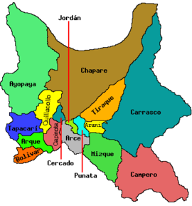 | |
| Municipalities (and seats) |
| |
This article is issued from
Wikipedia.
The text is licensed under Creative Commons - Attribution - Sharealike.
Additional terms may apply for the media files.