Waikari
| Waikari | |
|---|---|
| town | |
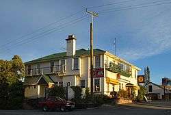 The Star and Garter Hotel in Waikari | |
 Waikari | |
| Coordinates: 42°58′S 172°41′E / 42.967°S 172.683°ECoordinates: 42°58′S 172°41′E / 42.967°S 172.683°E | |
| Country | New Zealand |
| Region | Canterbury |
| Territorial authority | Hurunui District |
| Population (2012 estimate) | |
| • Total | 800 |
| Time zone | UTC+12 (New Zealand Standard Time) |
| • Summer (DST) | UTC+13 (New Zealand Daylight Time) |
| Postcode | 7420 |
Waikari (Maori name Wai: river; kari: ditch or trench) is a small town in the Canterbury region of New Zealand's South Island.
Its Anglican parish church is the Church of Ascension, 79 Princes Street, Waikari, where William Orange was vicar in the 1920s.[1]
Waikari is located on State Highway 7 near the Weka Pass and was served by the Waiau Branch railway from 6 April 1882 until its closure on 15 January 1978. The section of the railway through the Weka Pass has been retained by the Weka Pass Railway and preserved trains operate between Waipara and Waikari.
The town is also located near the site of Māori cave art and rock drawings in the Weka Pass Reserve.
Notable people
- Derek Quigley, politician
References
- ↑ Clark, Jeremy J. "William Alfred Orange". Dictionary of New Zealand Biography. Ministry for Culture and Heritage. Retrieved 4 February 2012.
External links
| Wikimedia Commons has media related to Waikari. |
This article is issued from
Wikipedia.
The text is licensed under Creative Commons - Attribution - Sharealike.
Additional terms may apply for the media files.