Waeng District
| Waeng แว้ง | |
|---|---|
| Amphoe | |
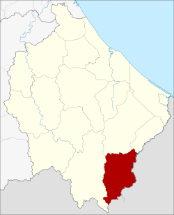 Amphoe location in Narathiwat Province | |
| Coordinates: 5°55′41″N 101°53′2″E / 5.92806°N 101.88389°ECoordinates: 5°55′41″N 101°53′2″E / 5.92806°N 101.88389°E | |
| Country | Thailand |
| Province | Narathiwat |
| Seat | Waeng |
| Area | |
| • Total | 347.3 km2 (134.1 sq mi) |
| Population (2005) | |
| • Total | 47,314 |
| • Density | 136.2/km2 (353/sq mi) |
| Time zone | UTC+7 (ICT) |
| Postal code | 96160 |
| Geocode | 9608 |
Waeng (Thai: แว้ง, pronounced [wɛ́ːŋ]) is the southernmost district (amphoe) of Narathiwat Province, southern Thailand.
History
The district dates back to the Tomo District (โต๊ะโมะ), which was a subordinate of Mueang Ra-ngae. The village grew bigger and bigger because of the gold mining there. 1935 a minor district (king amphoe) covering the central part of Tomo was established and named Pa Cho (ปาโจ).[1] 1939 the minor district received the name Tomo because it contained the sub-district named Tomo, and the parent district was renamed Waeng.[2] In 1953 the minor district Tomo was abolished and included in Waeng again.[3] In 1957 the Sub-district Tomo was also abolished and included in Sub-district Samong,[4] which then formed part of area split off as minor district Sukhirin in 1977.
Geography
Neighboring districts are (from the west clockwise) Sukhirin, Su-ngai Padi and Su-ngai Kolok. To the south is the Kelantan state of Malaysia.
At the village of Ban Buketa, a Malaysia-Thailand border border crossing to the neighboring Malaysian town of Bukit Bunga.[5] A part of Hala-Bala wildlife sanctuary is in the district.
Administration
The district is divided into six sub-districts (tambon), which are further subdivided into 45 villages (muban). There are two townships (thesaban tambon) within the district. Waeng covers parts of the tambon Waeng, and Buketa covers parts of tambon Lochut.
| No. | Name | Thai name | Villages | Pop. | |
|---|---|---|---|---|---|
| 1. | Waeng | แว้ง | 7 | 12465 | |
| 2. | Kayu Khla | กายูคละ | 9 | 7308 | |
| 3. | Kholo | ฆอเลาะ | 7 | 6700 | |
| 4. | Lochut | โละจูด | 8 | 10677 | |
| 5. | Mae Dong | แม่ดง | 7 | 6009 | |
| 6. | Erawan | เอราวัณ | 7 | 4155 |
References
- ↑ ประกาศกระทรวงมหาดไทย เรื่อง ตั้งกิ่งอำเภอปาโจ (PDF). Royal Gazette (in Thai). 52 (0 ง): 2501. November 17, 1935.
- ↑ พระราชกฤษฎีกาเปลี่ยนนามอำเภอ กิ่งอำเภอ และตำบลบางแห่ง พุทธศักราช ๒๔๘๒ (PDF). Royal Gazette (in Thai). 56 (0 ก): 354–364. April 17, 1939.
- ↑ ประกาศกระทรวงมหาดไทย เรื่อง ยุบกิ่งอำเภอโต๊ะโมะ อำเภอแว้ง จังหวัดนราธิวาส (PDF). Royal Gazette (in Thai). 70 (56 ง): 3062. September 1, 1953.
- ↑ ประกาศกระทรวงมหาดไทย เรื่อง ยุบและเปลี่ยนแปลงเขตตำบลในท้องที่อำเภอแว้ง จังหวัดนราธิวาส (PDF). Royal Gazette (in Thai). 74 (25 ง): 679. March 12, 1957.
- ↑ Official Website for Ministry of Foreign Affairs, Malaysia
External links