Wade Township, Jasper County, Illinois
| Wade Township | |
|---|---|
| Township | |
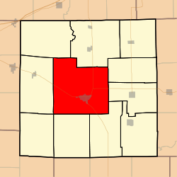 Location in Jasper County | |
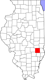 Jasper County's location in Illinois | |
| Coordinates: 39°00′49″N 88°10′51″W / 39.01361°N 88.18083°WCoordinates: 39°00′49″N 88°10′51″W / 39.01361°N 88.18083°W | |
| Country | United States |
| State | Illinois |
| County | Jasper |
| Established | November 8, 1859 |
| Area | |
| • Total | 74.33 sq mi (192.5 km2) |
| • Land | 73.96 sq mi (191.6 km2) |
| • Water | 0.37 sq mi (1.0 km2) 0.50% |
| Elevation | 505 ft (154 m) |
| Population (2010) | |
| • Estimate (2016)[1] | 4,384 |
| • Density | 60.5/sq mi (23.4/km2) |
| Time zone | UTC-6 (CST) |
| • Summer (DST) | UTC-5 (CDT) |
| ZIP codes | 62448, 62479 |
| FIPS code | 17-079-78357 |
Wade Township is one of eleven townships in Jasper County, Illinois, USA. As of the 2010 census, its population was 4,475 and it contained 2,082 housing units.[2]
Geography
According to the 2010 census, the township has a total area of 74.33 square miles (192.5 km2), of which 73.96 square miles (191.6 km2) (or 99.50%) is land and 0.37 square miles (0.96 km2) (or 0.50%) is water.[2]
Cities, towns, villages
Unincorporated towns
- Falmouth at 39°03′17″N 88°08′44″W / 39.054764°N 88.145594°W
- Lis at 39°01′12″N 88°15′37″W / 39.020043°N 88.260319°W
(This list is based on USGS data and may include former settlements.)
Adjacent townships
- Crooked Creek Township (northeast)
- Hunt City Township (east)
- Willow Hill Township (east)
- Fox Township (southeast)
- Smallwood Township (south)
- South Muddy Township (southwest)
- North Muddy Township (west)
- Grove Township (northwest)
Cemeteries
The township contains these twenty-two cemeteries: Bowers, Brick, Burford, Carter, Christian Chapel, Coburn, Gila Lutheran, Higgins/Colburn, Hickory, Jasper Family, Jones, Kibler, Liberty, Miller/Yager, Mt Calvery, New Saint Peters, Old Jasper County Poor Farm, Old Saint Peters, Redford, Riverside, Vanderhoof and West Lawn.
Major highways
Airports and landing strips
- Jasper County Safety Council Heliport
Rivers
Lakes
- Glen Lake
Landmarks
Demographics
| Historical population | |||
|---|---|---|---|
| Census | Pop. | %± | |
| Est. 2016 | 4,384 | [1] | |
| U.S. Decennial Census[3] | |||
School districts
- Jasper County Community Unit School District 1
Political districts
- Illinois' 19th congressional district
- State House District 108
- State Senate District 54
References
- "Wade Township, Jasper County, Illinois". Geographic Names Information System. United States Geological Survey. Retrieved 2010-01-17.
- United States Census Bureau 2007 TIGER/Line Shapefiles
- United States National Atlas
- 1 2 "Population and Housing Unit Estimates". Retrieved June 9, 2017.
- 1 2 "Population, Housing Units, Area, and Density: 2010 - County -- County Subdivision and Place -- 2010 Census Summary File 1". United States Census. Retrieved 2013-05-28.
- ↑ "Census of Population and Housing". Census.gov. Retrieved June 4, 2016.
External links
Municipalities and communities of Jasper County, Illinois, United States | ||
|---|---|---|
| Cities | ||
| Villages | ||
| Townships | ||
| Unincorporated communities | ||