Vysoká Pec (Chomutov District)
| Vysoká Pec | |||
|---|---|---|---|
| Municipality | |||
 | |||
| |||
 Location in Chomutov District | |||
 Vysoká Pec Location in the Czech Republic | |||
| Coordinates: 50°31′45″N 13°28′21″E / 50.52917°N 13.47250°ECoordinates: 50°31′45″N 13°28′21″E / 50.52917°N 13.47250°E | |||
| Country |
| ||
| Region | Ústí nad Labem | ||
| District | Chomutov | ||
| Area | |||
| • Total | 19.56 km2 (7.55 sq mi) | ||
| Elevation | 295 m (968 ft) | ||
| Population (2006) | |||
| • Total | 858 | ||
| • Density | 44/km2 (110/sq mi) | ||
| Postal code | 431 11 to 431 59 | ||
| Website | http://www.vysokapec.cz | ||
_vlajka.jpg)
_znak.jpg)
Vysoká Pec (German: Hohenofen) is a village and municipality (obec) in Chomutov District in the Ústí nad Labem Region of the Czech Republic.
The municipality covers an area of 19.56 square kilometres (7.55 sq mi), and has a population of 858 (as at 28 August 2006).
Vysoká Pec lies approximately 9 kilometres (6 mi) north-east of Chomutov, 43 km (27 mi) west of Ústí nad Labem, and 84 km (52 mi) north-west of Prague.
Gallery
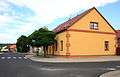 Jirkovská street
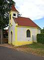 Small chapel
References
| Wikimedia Commons has media related to Vysoká Pec (Chomutov District). |
This article is issued from
Wikipedia.
The text is licensed under Creative Commons - Attribution - Sharealike.
Additional terms may apply for the media files.