Volin, South Dakota
| Volin, South Dakota | |
|---|---|
| Town | |
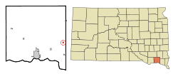 Location in Yankton County and the state of South Dakota | |
| Coordinates: 42°57′28″N 97°10′52″W / 42.95778°N 97.18111°WCoordinates: 42°57′28″N 97°10′52″W / 42.95778°N 97.18111°W | |
| Country | United States |
| State | South Dakota |
| County | Yankton |
| Incorporated | 1901[1] |
| Area[2] | |
| • Total | 0.20 sq mi (0.52 km2) |
| • Land | 0.20 sq mi (0.52 km2) |
| • Water | 0 sq mi (0 km2) |
| Elevation | 1,194 ft (364 m) |
| Population (2010)[3] | |
| • Total | 161 |
| • Estimate (2012[4]) | 161 |
| • Density | 805.0/sq mi (310.8/km2) |
| Time zone | UTC-6 (Central (CST)) |
| • Summer (DST) | UTC-5 (CDT) |
| ZIP code | 57072 |
| Area code(s) | 605 |
| FIPS code | 46-67780[5] |
| GNIS feature ID | 1258771[6] |
Volin (pronounced VAH'-lin[7]) is a town in Yankton County, South Dakota, United States. The population was 161 at the 2010 census.
Geography
Volin is located at 42°57′28″N 97°10′52″W / 42.95778°N 97.18111°W (42.957852, -97.181049).[8]
According to the United States Census Bureau, the town has a total area of 0.20 square miles (0.52 km2), all of it land.[2]
History
A post office called Volin has been in operation since 1887.[9] The town was named for Henry P. Volin, a local landowner.[10]
Demographics
| Historical population | |||
|---|---|---|---|
| Census | Pop. | %± | |
| 1910 | 286 | — | |
| 1920 | 314 | 9.8% | |
| 1930 | 283 | −9.9% | |
| 1940 | 292 | 3.2% | |
| 1950 | 197 | −32.5% | |
| 1960 | 171 | −13.2% | |
| 1970 | 157 | −8.2% | |
| 1980 | 156 | −0.6% | |
| 1990 | 175 | 12.2% | |
| 2000 | 207 | 18.3% | |
| 2010 | 161 | −22.2% | |
| Est. 2016 | 162 | [11] | 0.6% |
| U.S. Decennial Census[12] | |||
2010 census
As of the census[3] of 2010, there were 161 people, 61 households, and 41 families residing in the town. The population density was 805.0 inhabitants per square mile (310.8/km2). There were 76 housing units at an average density of 380.0 per square mile (146.7/km2). The racial makeup of the town was 99.4% White and 0.6% from two or more races.
There were 61 households of which 39.3% had children under the age of 18 living with them, 50.8% were married couples living together, 11.5% had a female householder with no husband present, 4.9% had a male householder with no wife present, and 32.8% were non-families. 21.3% of all households were made up of individuals and 8.2% had someone living alone who was 65 years of age or older. The average household size was 2.64 and the average family size was 3.10.
The median age in the town was 33.8 years. 29.8% of residents were under the age of 18; 8.1% were between the ages of 18 and 24; 26.8% were from 25 to 44; 26.1% were from 45 to 64; and 9.3% were 65 years of age or older. The gender makeup of the town was 52.8% male and 47.2% female.
2000 census
As of the census[5] of 2000, there were 207 people, 74 households, and 54 families residing in the town. The population density was 1,068.5 people per square mile (420.6/km²). There were 81 housing units at an average density of 418.1 per square mile (164.6/km²). The racial makeup of the town was 94.20% White, 3.86% Native American, and 1.93% from two or more races.
There were 74 households out of which 45.9% had children under the age of 18 living with them, 52.7% were married couples living together, 10.8% had a female householder with no husband present, and 27.0% were non-families. 24.3% of all households were made up of individuals and 10.8% had someone living alone who was 65 years of age or older. The average household size was 2.80 and the average family size was 3.35.
In the town, the population was spread out with 33.8% under the age of 18, 13.5% from 18 to 24, 23.7% from 25 to 44, 20.3% from 45 to 64, and 8.7% who were 65 years of age or older. The median age was 27 years. For every 100 females, there were 101.0 males. For every 100 females age 18 and over, there were 107.6 males.
The median income for a household in the town was $30,938, and the median income for a family was $39,375. Males had a median income of $29,583 versus $17,000 for females. The per capita income for the town was $12,123. About 22.0% of families and 23.5% of the population were below the poverty line, including 21.4% of those under the age of eighteen and 50.0% of those sixty five or over.
References
- ↑ "SD Towns" (PDF). South Dakota State Historical Society. Retrieved 2010-02-16.
- 1 2 "US Gazetteer files 2010". United States Census Bureau. Archived from the original on January 24, 2012. Retrieved June 21, 2012.
- 1 2 "American FactFinder". United States Census Bureau. Retrieved 2012-06-21.
- ↑ "Population Estimates". United States Census Bureau. Archived from the original on June 17, 2013. Retrieved May 29, 2013.
- 1 2 "American FactFinder". United States Census Bureau. Retrieved 2008-01-31.
- ↑ "US Board on Geographic Names". United States Geological Survey. 2007-10-25. Retrieved 2008-01-31.
- ↑ "Broadcast Pronunciation Guide and South Dakota Pronunciations". Associated Press. Archived from the original on 2011-06-14. Retrieved 2009-11-10.
- ↑ "US Gazetteer files: 2010, 2000, and 1990". United States Census Bureau. 2011-02-12. Retrieved 2011-04-23.
- ↑ "Yankton County". Jim Forte Postal History. Retrieved 30 March 2015.
- ↑ Chicago and North Western Railway Company (1908). A History of the Origin of the Place Names Connected with the Chicago & North Western and Chicago, St. Paul, Minneapolis & Omaha Railways. p. 134.
- ↑ "Population and Housing Unit Estimates". Retrieved June 9, 2017.
- ↑ "Census of Population and Housing". Census.gov. Archived from the original on May 12, 2015. Retrieved June 4, 2015.
Municipalities and communities of Yankton County, South Dakota, United States | ||
|---|---|---|
| Cities | 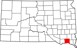 | |
| Towns | ||
| Footnotes | ‡This populated place also has portions in an adjacent county or counties | |