Villers-aux-Bois
| Villers-aux-Bois | |
|---|---|
| Commune | |
 Villers-aux-Bois Location within Grand Est region  Villers-aux-Bois | |
| Coordinates: 48°56′04″N 3°56′14″E / 48.9344°N 3.9372°ECoordinates: 48°56′04″N 3°56′14″E / 48.9344°N 3.9372°E | |
| Country | France |
| Region | Grand Est |
| Department | Marne |
| Arrondissement | Épernay |
| Canton | Vertus-Plaine Champenoise |
| Intercommunality | Communauté de communes de la Région de Vertus |
| Government | |
| • Mayor | Michel Rouyer |
| Area1 | 5.11 km2 (1.97 sq mi) |
| Population (1999)2 | 231 |
| • Density | 45/km2 (120/sq mi) |
| Time zone | UTC+1 (CET) |
| • Summer (DST) | UTC+2 (CEST) |
| INSEE/Postal code | 51630 /51130 |
|
1 French Land Register data, which excludes lakes, ponds, glaciers > 1 km2 (0.386 sq mi or 247 acres) and river estuaries. 2 Population without double counting: residents of multiple communes (e.g., students and military personnel) only counted once. | |
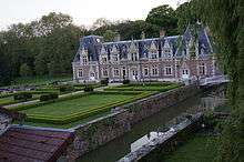
Villers-aux-Bois is a commune in the Marne department in north-eastern France.
See also
castle
| Wikimedia Commons has media related to Villers-aux-Bois. |
This article is issued from
Wikipedia.
The text is licensed under Creative Commons - Attribution - Sharealike.
Additional terms may apply for the media files.