Boursault
| Boursault | |
|---|---|
| Commune | |
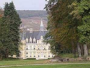 | |
 Boursault Location within Grand Est region  Boursault | |
| Coordinates: 49°03′39″N 3°50′44″E / 49.0608°N 3.8456°ECoordinates: 49°03′39″N 3°50′44″E / 49.0608°N 3.8456°E | |
| Country | France |
| Region | Grand Est |
| Department | Marne |
| Arrondissement | Épernay |
| Canton | Dormans-Paysages de Champagne |
| Intercommunality | Deux Vallées |
| Government | |
| • Mayor (2008–2014) | Thérèse Lebrun-David |
| Area1 | 16.45 km2 (6.35 sq mi) |
| Population (2012)2 | 420 |
| • Density | 26/km2 (66/sq mi) |
| Time zone | UTC+1 (CET) |
| • Summer (DST) | UTC+2 (CEST) |
| INSEE/Postal code | 51076 /51480 |
| Elevation |
65–245 m (213–804 ft) (avg. 185 m or 607 ft) |
|
1 French Land Register data, which excludes lakes, ponds, glaciers > 1 km2 (0.386 sq mi or 247 acres) and river estuaries. 2 Population without double counting: residents of multiple communes (e.g., students and military personnel) only counted once. | |
Boursault is a commune of the Marne department in northeastern France.
Population
| Historical population | ||
|---|---|---|
| Year | Pop. | ±% |
| 1793 | 470 | — |
| 1800 | 503 | +7.0% |
| 1806 | 571 | +13.5% |
| 1821 | 550 | −3.7% |
| 1831 | 600 | +9.1% |
| 1836 | 603 | +0.5% |
| 1841 | 646 | +7.1% |
| 1846 | 662 | +2.5% |
| 1851 | 641 | −3.2% |
| 1856 | 578 | −9.8% |
| 1861 | 652 | +12.8% |
| 1866 | 683 | +4.8% |
| 1872 | 628 | −8.1% |
| 1876 | 706 | +12.4% |
| 1881 | 672 | −4.8% |
| 1886 | 691 | +2.8% |
| 1891 | 687 | −0.6% |
| 1896 | 620 | −9.8% |
| 1901 | 610 | −1.6% |
| 1906 | 634 | +3.9% |
| 1911 | 565 | −10.9% |
| 1921 | 602 | +6.5% |
| 1926 | 549 | −8.8% |
| 1931 | 540 | −1.6% |
| 1936 | 461 | −14.6% |
| 1946 | 478 | +3.7% |
| 1954 | 466 | −2.5% |
| 1962 | 474 | +1.7% |
| 1968 | 459 | −3.2% |
| 1975 | 466 | +1.5% |
| 1982 | 488 | +4.7% |
| 1990 | 462 | −5.3% |
| 1999 | 500 | +8.2% |
| 2006 | 469 | −6.2% |
| 2009 | 461 | −1.7% |
| 2012 | 420 | −8.9% |
See also
References
| Wikimedia Commons has media related to Boursault. |
This article is issued from
Wikipedia.
The text is licensed under Creative Commons - Attribution - Sharealike.
Additional terms may apply for the media files.