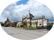
Sommepy-Tahure
| Sommepy-Tahure | |
|---|---|
| Commune | |
 Sommepy-Tahure Location within Grand Est region  Sommepy-Tahure | |
| Coordinates: 49°15′09″N 4°33′29″E / 49.2525°N 4.5581°ECoordinates: 49°15′09″N 4°33′29″E / 49.2525°N 4.5581°E | |
| Country | France |
| Region | Grand Est |
| Department | Marne |
| Arrondissement | Châlons-en-Champagne |
| Canton | Argonne Suippe et Vesle |
| Intercommunality | Communauté de communes de la Région de Suippes |
| Government | |
| • Mayor | Marie Ange Gangand |
| Area1 | 68.24 km2 (26.35 sq mi) |
| Population (1999)2 | 539 |
| • Density | 7.9/km2 (20/sq mi) |
| Time zone | UTC+1 (CET) |
| • Summer (DST) | UTC+2 (CEST) |
| INSEE/Postal code | 51544 /51600 |
|
1 French Land Register data, which excludes lakes, ponds, glaciers > 1 km2 (0.386 sq mi or 247 acres) and river estuaries. 2 Population without double counting: residents of multiple communes (e.g., students and military personnel) only counted once. | |
Sommepy-Tahure is a commune in the Marne department in north-eastern France.
During World War 1, it was known as Somme-Py.
See also
| Wikimedia Commons has media related to Sommepy-Tahure. |
This article is issued from
Wikipedia.
The text is licensed under Creative Commons - Attribution - Sharealike.
Additional terms may apply for the media files.