Viewpark
| Viewpark | |
|---|---|
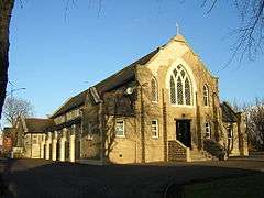 St Columba's Roman Catholic Church | |
| Population | 16,020 |
| OS grid reference | NS712612 |
| Lieutenancy area | |
| Country | Scotland |
| Sovereign state | United Kingdom |
| Post town | GLASGOW |
| Postcode district | G71 |
| Dialling code | 01698 |
| Police | Scottish |
| Fire | Scottish |
| Ambulance | Scottish |
| EU Parliament | Scotland |
| UK Parliament | |
| Scottish Parliament | |
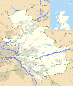
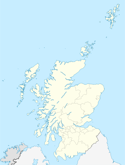
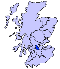
Viewpark is a town in North Lanarkshire, Scotland. Situated immediately north-east of Uddingston, Viewpark is adjacent to Tannochside, and is 2 kilometres (1.2 mi) west of Bellshill. It has an estimated population of 16,020.[1][2]
History
Viewpark was originally built to house miners and was erected quickly. Construction work on "The Scheme" starting late 1950s and with houses down to Laburnum Road being occupied around the beginning of the 1960s. These supplement housing built adjacent and parallel to the "Top Road" - the Old Edinburgh Road where could be found the Police Station (whose siren continued to sound practice air raid warning into the 1960s) alongside the local football ground and opposite The Royal Oak Bar. Dominic's Shop (now long closed) alongside "The Lane" allowing quick access to the adjoining community and the local swing park on Douglas Street - named for the association with the Douglas (Home?) estate the houses were built upon. . The older houses were originally called "The Raws". Viewpark grew steadily at this time to support housing demand in an area which was thriving at the time with industries such as Mining and Ranco and the Caterpillar Tractor Co which opened its doors in 1959 thus creating a boom in the population of the area which is known today as Viewpark.
1956 and the main thoroughfare in Viewpark, Laburnum Road, often referred to as "The Burma Road", in reference to its length, was well underway in its construction. That same year, the local council set up what has now become Burnhead Bowling Club, along with an adjacent tennis court. A new church was built, Burnhead Parish Church, on Laburnum Road, opposite its junction with Burnhead Street.
Located near the older housing within Viewpark is the Glen, also known locally as the "Viewpark Glen"[3] which expands across Uddingston, Bothwell, Hamilton, Coatbridge and Motherwell. Within the Glen lies famous Roman ruins such as a Roman bridge as well as tombs dating back centuries further.[4]
The demolition of the miners homes, referred to as The Miners Rows, in Tannochside, which released land for the erection of the Caterpillar Tractor Co. led to an influx of displaced families into the Viewpark area. A similar fate befell the Miners Rows at Cockhill, located due east of Laburnum Road. That land has now been utilised as a football field, with a shopping area on the north side of Old Edinburgh Road. Kerrs Farm at Cockhill, also disappeared, and that land, which extended between Laburnum Road and the new bypass road, the A725, was used to create Righead Industrial Estate.
A shopping complex was added in the centre of the new housing complex, aptly located in Market Place, just off Burnhead Street, opposite the old rose gardens (now long gone) - now replaced by the Community Centre, a Sports Complex, and a Medical Centre. This being immediately opposite the Gala Day Park where the local Miners Welfare would organise their annual MayDay celebration where each child was presented with a Tunnock's Box of cakes and fancies after competing in games and races. That park is still there.
Education
St Columbas Primary School was on Old Edinburgh Road. The original wooden structure was demolished after fire damage in the early 1960s. The replacement school building has since been knocked down and replaced by private housing.
St Catherine's Junior Secondary was built at the corner of Laburnum Road and New Edinburgh Road. It opened in the late 1960s after campaigning by local activists whose children had previously had to travel to Uddingston or Motherwell for secondary education.
In 2014, plans were put in place with the local council to construct an ASDA food store across the road from John Paul Primary School, near the Viewpark Glen, where the newer modern school which combined and accommodates the pupils of St Columba and St.Gabriels Primary School.[5] However, the plans were scrapped.
Sport
Thorniewood United, a junior football club, is based in the area.
Notable people
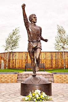
Footballer Jimmy Johnstone, who played for Celtic and the Scotland national team, was born in Viewpark and lived locally throughout his life. A memorial garden containing a statue of Johnstone was opened in 2011, in the grounds of the former St Columba's Primary School, which he attended.[6]
Chic McSherry, the entrepreneur, musician and author grew up in Viewpark.
Kevin Budinauckas (footballer)
References
- ↑ "Key Facts 2016 - Demography". North Lanarkshire Council. Retrieved 3 January 2018.
- ↑ "Estimated population of localities by broad age groups, mid-2012" (PDF). Retrieved 3 January 2018.
- ↑ http://www.archiuk.com/cgi-bin/web-archi.pl?PlacenameFromPlacenameFinder=Viewpark&CountyFromPlacenameFinder=Strathclyde&distance=10000&ARCHIFormNGRLetter=NS&ARCHIFormNGR_x=70&ARCHIFormNGR_y=61&info2search4=placename_search
- ↑ http://www.dailyrecord.co.uk/news/local-news/pictures-kids-families-protest-save-3253656
- ↑ http://news.stv.tv/west-central/240877-15m-asda-to-bring-200-jobs-to-viewpark-in-north-lanarkshire/
- ↑ "Viewpark honours football hero Jimmy Johnstone". Daily Record. Glasgow. 17 August 2011. Retrieved 4 January 2018.
External links
![]()