Name
The municipality (originally the parish) is named after the old Slidre farm (Old Norse: Slíðrar), since the first church was built here. The name is probably derived from slíðr which means "sheath" (which is probably referring to a long depression near the church). The meaning of the name Vestre Slidre is "(the) western (part of) Slidre" (since the parish and municipality of Slidre was divided in 1849.)[2]
Coat-of-arms
The coat-of-arms was made official in 1987, but it originally was a seal belonging to a medieval nobleman from the district.
History
High above Slidre there is an ancient burial ground called the Garberg site. At this site, there is a runestone which reads I Godguest wrote the runes. This stone is known as the Einang stone.
Vestre Sildre figures prominently in the Norse Sagas:
- Harald Fairhair was, according to the Sagas, the first king (872 – 930) of Norway. In 866, he made the first of a series of conquests over a number of petty kingdoms. One of the encounters leading to the overall conquest was with Skallagrim Kveldulvssøn in Vestre Slidre. In 872, after winning the Battle of Hafrsfjord near Stavanger, he found himself king of the whole country.[4]
- In the Heimskringla attributed to Snorri Sturluson, it is recorded that in 1023 Saint Olav came unannounced from Sogn as part of his campaign to Christianize Norway. At Slidre he caught the peasants unawares, and secured all their boats. As a condition for having their boats restored, they accepted Christianity.[4]
Churches
- The ruins of Mo church (Mo kirkeruin) are located on the west side of Slidrefjord. The medieval church of stone was built ca. 1215 and was probably out of use after the Reformation. The ruins were excavated and restored in the period 1972-1977.[5]
- Slidredomen, a medieval stone-built church, was once the main church for Valdres. The church is built around 1170. The Church is entirely made of stone. Its treasures formerly included a chalice presented by Bishop Salomon of Oslo (1322-1352), the only Bishop in Norway to survive the Black Death. Slidredomen is also known to have had a local bishop.[4]
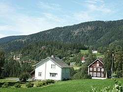
- Lomen stave church is located in the small village of Lomen. It was built circa 1170. The exterior of the present Lomen church is post-Reformation, and only the wall and roof timbers remain from the original building.[4]
- Høre stave church (the Dano-Norwegian spelling of the word Høre was Hurum), was almost entirely rebuilt and extended. Only the south door, with dragons and other carvings, still exists.[4]
Ruins of Mo church
Einang stone, located at its original location atop the Garberg site
Slidredomen, medieval stone church
Lomen stave church during painting the summer of 2005
Geography
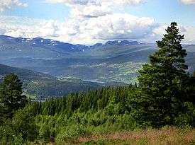
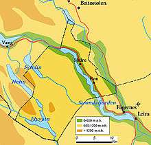
View over Lomen from the Garberg site, with Vang slightly to the left and Jotunheimen in the background. Down by the lake and to the right is Lomen.
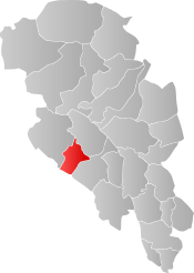
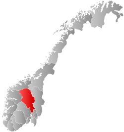
Vestre Slidre is bordered to the northwest by the municipality of Vang, to the northeast by Øystre Slidre, to the east by Nord-Aurdal, and to the southwest by Hemsedal.
Vestre Slidre is part of the Valdres region in south-central Norway. It is situated between Gudbrandsdal and Hallingdal.
External links
 |
Wikivoyage has a travel guide for Oppland. |
|
Wikivoyage has a travel guide for Valdres. |

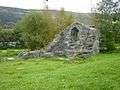 Ruins of Mo church
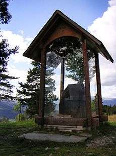 Einang stone, located at its original location atop the Garberg site
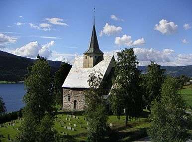 Slidredomen, medieval stone church
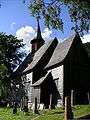 Lomen stave church during painting the summer of 2005