Verkeerdevlei
| Verkeerdevlei | |
|---|---|
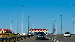 The N1-tollgate near Verkeerdevlei | |
 Verkeerdevlei  Verkeerdevlei Verkeerdevlei (South Africa)  Verkeerdevlei Verkeerdevlei (Africa) | |
| Coordinates: 28°50′S 26°47′E / 28.833°S 26.783°ECoordinates: 28°50′S 26°47′E / 28.833°S 26.783°E | |
| Country | South Africa |
| Province | Free State |
| District | Lejweleputswa |
| Municipality | Masilonyana |
| Area[1] | |
| • Total | 7.9 km2 (3.1 sq mi) |
| Population (2011)[1] | |
| • Total | 2,135 |
| • Density | 270/km2 (700/sq mi) |
| Racial makeup (2011)[1] | |
| • Black African | 95.0% |
| • Coloured | 0.7% |
| • Indian/Asian | 0.3% |
| • White | 3.7% |
| • Other | 0.3% |
| First languages (2011)[1] | |
| • Sotho | 78.4% |
| • Xhosa | 5.5% |
| • Afrikaans | 5.3% |
| • Tswana | 4.2% |
| • Other | 6.6% |
| Time zone | UTC+2 (SAST) |
| Postal code (street) | 9401 |
| PO box | 9401 |
| Area code | 051 |
Verkeerdevlei is a small town in the Free State province of South Africa.
Town 39 km south-east of Brandfort. Afrikaans for ‘wrong marsh’, the name probably refers to an east-west flow of water in an area where the direction is normally west-east.[2]
References
- 1 2 3 4 Sum of the Main Places Verkeerdevlei and Tshepong from Census 2011.
- ↑ "Dictionary of Southern African Place Names (Public Domain)". Human Science Research Council. p. 457.
Municipalities and communities of Lejweleputswa District Municipality, Free State | ||
|---|---|---|
District seat: Welkom | ||
| Masilonyana | .svg.png) | |
| Tokologo | ||
| Tswelopele | ||
| Matjhabeng | ||
| Nala | ||
This article is issued from
Wikipedia.
The text is licensed under Creative Commons - Attribution - Sharealike.
Additional terms may apply for the media files.