Hoopstad
| Hoopstad | |
|---|---|
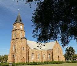 Hoopstad Church | |
 Hoopstad  Hoopstad Hoopstad (South Africa)  Hoopstad Hoopstad (Africa) | |
| Coordinates: 27°50′S 25°55′E / 27.833°S 25.917°ECoordinates: 27°50′S 25°55′E / 27.833°S 25.917°E | |
| Country | South Africa |
| Province | Free State |
| District | Lejweleputswa |
| Municipality | Tswelopele |
| Established | 1873[1] |
| Area[2] | |
| • Total | 30.2 km2 (11.7 sq mi) |
| Population (2011)[2] | |
| • Total | 16,033 |
| • Density | 530/km2 (1,400/sq mi) |
| Racial makeup (2011)[2] | |
| • Black African | 91.9% |
| • Coloured | 2.0% |
| • Indian/Asian | 0.4% |
| • White | 5.5% |
| • Other | 0.3% |
| First languages (2011)[2] | |
| • Sotho | 52.0% |
| • Xhosa | 18.5% |
| • Tswana | 14.6% |
| • Afrikaans | 7.1% |
| • Other | 7.8% |
| Time zone | UTC+2 (SAST) |
| Postal code (street) | 9479 |
| PO box | 9479 |
| Area code | 053 |
The key town of Hoopstad is situated on the R700 Highway between Bloemfontein and the North West Province. This area is considered to be the richest maize-producing district in South Africa. The town is located near the Bloemhof Dam which is situated on the Vaal River. The Sandveld Nature Reserve is positioned alongside the Bloemhof Dam. Hopetown and Hoopstad are two different towns and often get confused.
History and activities
The town of Hoopstad was initially founded in 1876 and named Hauptstad after Mr Haupt, a surveyor. The translation of Hauptstad into Afrikaans means Capital, which it clearly wasn’t and the town was therefore renamed Hoopstad. The town, whose name means "Hope City" in Afrikaans, was established on the one side of the large farm Kameeldoorns, with another town Bultfontein on the other side.
References
| Wikimedia Commons has media related to Hoopstad. |
Places adjacent to Hoopstad | |
|---|---|
Municipalities and communities of Lejweleputswa District Municipality, Free State | ||
|---|---|---|
District seat: Welkom | ||
| Masilonyana | .svg.png) | |
| Tokologo | ||
| Tswelopele | ||
| Matjhabeng | ||
| Nala | ||