Riebeeckstad
| Riebeeckstad | |
|---|---|
 Riebeeckstad  Riebeeckstad Riebeeckstad (South Africa)  Riebeeckstad Riebeeckstad (Africa) | |
| Coordinates: 27°55′08″S 26°49′08″E / 27.918777°S 26.818777°ECoordinates: 27°55′08″S 26°49′08″E / 27.918777°S 26.818777°E | |
| Country | South Africa |
| Province | Free State |
| District | Lejweleputswa |
| Municipality | Matjhabeng |
| Government | |
| • Type | Part of Municipality |
| • Mayor | Sebenzile Ngangelizwe (ANC) |
| Area[1] | |
| • Total | 13.22 km2 (5.10 sq mi) |
| Population (2011)[1] | |
| • Total | 11,268 |
| • Density | 850/km2 (2,200/sq mi) |
| Racial makeup (2011)[1] | |
| • Black African | 49.2% |
| • Coloured | 1.8% |
| • Indian/Asian | 0.3% |
| • White | 48.4% |
| • Other | 0.4% |
| First languages (2011)[1] | |
| • Afrikaans | 48.3% |
| • Sotho | 32.4% |
| • English | 8.6% |
| • Xhosa | 4.0% |
| • Other | 6.7% |
| Time zone | UTC+2 (SAST) |
| Postal code (street) | 9459 |
| PO box | 9469 |
| Area code | 057 |
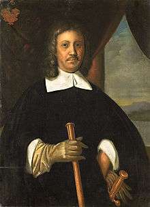
Painting of Jan van Riebeeck by E.C. Godée Molsbergen.
Riebeeckstad is a suburb 5 km east of the city of Welkom located in the Lejweleputswa District Municipality of the Free State province of South Africa.
It is named after Jan van Riebeeck and was established as an upper-class suburb, void of mine shafts, for people working in Welkom or on the Free State goldfields. The suburb is the largest in the city of Welkom and has a significant white population. Afrikaans is most spoken language in the suburb followed by Sesotho and English. The suburb is located few kilometres from the Central University of Technology in Welkom.
References
- 1 2 3 4 "Main Place Riebeeckstad". Census 2011.
Municipalities and communities of Lejweleputswa District Municipality, Free State | ||
|---|---|---|
District seat: Welkom | ||
| Masilonyana | .svg.png) | |
| Tokologo | ||
| Tswelopele | ||
| Matjhabeng | ||
| Nala | ||
This article is issued from
Wikipedia.
The text is licensed under Creative Commons - Attribution - Sharealike.
Additional terms may apply for the media files.