Jastrebac
| Jastrebac | |
|---|---|
|
Јастребац | |
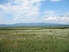 Jastrebac as seen from Toplica on the south | |
| Highest point | |
| Elevation | 1,491 m (4,892 ft) [1] |
| Coordinates | 43°23′31″N 21°26′57″E / 43.39194°N 21.44917°ECoordinates: 43°23′31″N 21°26′57″E / 43.39194°N 21.44917°E |
| Geography | |
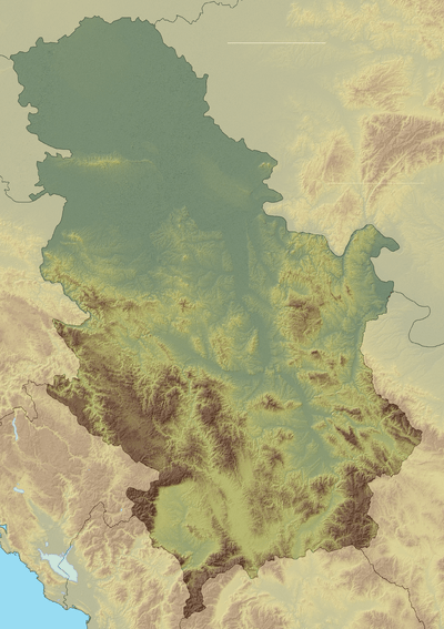 Jastrebac Location in Serbia | |
| Location | Southern Serbia |
Jastrebac (Serbian Cyrillic: Јастребац) is a mountain in central Serbia, between cities of Niš, Kruševac and Prokuplje. It consists of two massifs, Great (Veliki) and Small (Mali) Jastrebac. Its highest peak Velika Đulica has an elevation of 1,491 meters above sea level.[2] It is well-forested and presents a popular hiking and mountaineering destination.
Jastrebac is bounded by the rivers of South Morava on the west, Toplica on the south and Rasina on the east. Despite the relatively low height, it is prominent because of the surrounding valleys. It is on the boundary of Dinaric, Balkan and Rhodopes mountain ranges, but cannot be clearly classified into either. The mountain is close to other mountain peaks such as Leskovik (4.4 miles away), and Šiljak Rtanj (6.5 miles away).
References
External links
| Wikimedia Commons has media related to Jastrebac. |