Melvern, Kansas
| Melvern, Kansas | |
|---|---|
| City | |
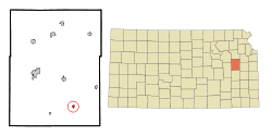 Location within Osage County and Kansas | |
 KDOT map of Osage County (legend) | |
| Coordinates: 38°30′27″N 95°38′18″W / 38.50750°N 95.63833°WCoordinates: 38°30′27″N 95°38′18″W / 38.50750°N 95.63833°W | |
| Country | United States |
| State | Kansas |
| County | Osage |
| Area[1] | |
| • Total | 0.35 sq mi (0.91 km2) |
| • Land | 0.35 sq mi (0.91 km2) |
| • Water | 0 sq mi (0 km2) |
| Elevation | 1,014 ft (309 m) |
| Population (2010)[2] | |
| • Total | 385 |
| • Estimate (2016)[3] | 363 |
| • Density | 1,100/sq mi (420/km2) |
| Time zone | UTC-6 (Central (CST)) |
| • Summer (DST) | UTC-5 (CDT) |
| ZIP code | 66510 |
| Area code | 785 |
| FIPS code | 20-45700 [4] |
| GNIS feature ID | 0477555 [5] |
| Website | melvernks.com |
Melvern is a city in Osage County, Kansas, United States, along the Marais des Cygnes River. As of the 2010 census, the city population was 385.[6]
History
Melvern was laid out in 1870.[7] It was named after the Malvern Hills, in Worcestershire, England.[8][9][10]
The first post office in Melvern was established in June 1870.[11]
Geography
Melvern is located at 38°30′27″N 95°38′18″W / 38.50750°N 95.63833°W (38.507446, -95.638332).[12] According to the United States Census Bureau, the city has a total area of 0.35 square miles (0.91 km2), all land.[1]
Demographics
| Historical population | |||
|---|---|---|---|
| Census | Pop. | %± | |
| 1880 | 103 | — | |
| 1890 | 461 | 347.6% | |
| 1900 | 469 | 1.7% | |
| 1910 | 505 | 7.7% | |
| 1920 | 422 | −16.4% | |
| 1930 | 445 | 5.5% | |
| 1940 | 368 | −17.3% | |
| 1950 | 389 | 5.7% | |
| 1960 | 376 | −3.3% | |
| 1970 | 455 | 21.0% | |
| 1980 | 481 | 5.7% | |
| 1990 | 423 | −12.1% | |
| 2000 | 429 | 1.4% | |
| 2010 | 385 | −10.3% | |
| Est. 2016 | 363 | [3] | −5.7% |
| U.S. Decennial Census | |||
Melvern is part of the Topeka, Kansas Metropolitan Statistical Area.
2010 census
As of the census[2] of 2010, there were 385 people, 159 households, and 109 families residing in the city. The population density was 1,100.0 inhabitants per square mile (424.7/km2). There were 184 housing units at an average density of 525.7 per square mile (203.0/km2). The racial makeup of the city was 96.6% White, 0.3% African American, 0.8% Asian, 0.3% from other races, and 2.1% from two or more races. Hispanic or Latino of any race were 2.3% of the population.
There were 159 households of which 30.8% had children under the age of 18 living with them, 52.2% were married couples living together, 8.8% had a female householder with no husband present, 7.5% had a male householder with no wife present, and 31.4% were non-families. 27.0% of all households were made up of individuals and 10% had someone living alone who was 65 years of age or older. The average household size was 2.39 and the average family size was 2.86.
The median age in the city was 40.8 years. 24.7% of residents were under the age of 18; 6% were between the ages of 18 and 24; 25.2% were from 25 to 44; 24.9% were from 45 to 64; and 19.2% were 65 years of age or older. The gender makeup of the city was 48.6% male and 51.4% female.
2000 census
As of the census[4] of 2000, there were 429 people, 173 households, and 120 families residing in the city. The population density was 1,297.3 people per square mile (501.9/km²). There were 202 housing units at an average density of 610.9 per square mile (236.3/km²). The racial makeup of the city was 98.14% White, 0.70% Native American, 0.23% from other races, and 0.93% from two or more races. Hispanic or Latino of any race were 0.93% of the population.
There were 173 households out of which 31.8% had children under the age of 18 living with them, 56.1% were married couples living together, 10.4% had a female householder with no husband present, and 30.6% were non-families. 28.9% of all households were made up of individuals and 14.5% had someone living alone who was 65 years of age or older. The average household size was 2.47 and the average family size was 3.00.
In the city, the population was spread out with 26.3% under the age of 18, 6.8% from 18 to 24, 28.9% from 25 to 44, 17.9% from 45 to 64, and 20.0% who were 65 years of age or older. The median age was 37 years. For every 100 females, there were 98.6 males. For every 100 females age 18 and over, there were 85.9 males.
The median income for a household in the city was $32,321, and the median income for a family was $50,833. Males had a median income of $30,313 versus $17,143 for females. The per capita income for the city was $16,206. About 5.3% of families and 9.2% of the population were below the poverty line, including 4.5% of those under age 18 and 9.2% of those age 65 or over.
Education
Melvern is a part of USD 456 Marais des Cygnes Valley. The district high school is Marais des Cygnes Valley High School. Mascot is Trojans.[13]
Prior to school unification, the Melvern High School mascot was Panthers. The Melvern Panthers won the Kansas State High School boys class B basketball championship in 1962.[14]
Parks and Recreation
References
- 1 2 "US Gazetteer files 2010". United States Census Bureau. Archived from the original on 2012-07-14. Retrieved 2012-07-06.
- 1 2 "American FactFinder". United States Census Bureau. Retrieved 2012-07-06.
- 1 2 "Population and Housing Unit Estimates". Retrieved June 9, 2017.
- 1 2 "American FactFinder". United States Census Bureau. Retrieved 2008-01-31.
- ↑ "US Board on Geographic Names". United States Geological Survey. 2007-10-25. Retrieved 2008-01-31.
- ↑ "2010 City Population and Housing Occupancy Status". U.S. Census Bureau. Archived from the original on July 21, 2011. Retrieved February 11, 2012.
- ↑ Blackmar, Frank Wilson (1912). Kansas: A Cyclopedia of State History, Volume 2. Standard Publishing Company. p. 265.
- ↑ Kansas State Historical Society (1916). Biennial Report of the Board of Directors of the Kansas State Historical Society. Kansas State Printing Plant. p. 255.
- ↑ Capace, Nancy (2000). Encyclopedia of Kansas. Somerset Publishers. p. 235.
- ↑ Gannett, Henry (1905). The Origin of Certain Place Names in the United States. U.S. Government Printing Office. p. 204.
- ↑ "Kansas Post Offices, 1828-1961". Kansas Historical Society. Archived from the original on 9 October 2013. Retrieved 22 June 2014.
- ↑ "US Gazetteer files: 2010, 2000, and 1990". United States Census Bureau. 2011-02-12. Retrieved 2011-04-23.
- ↑ "Marais des Cygnes Valley USD 456". USD 456. Retrieved 5 January 2017.
- ↑ "Basketball". KSHSAA. Retrieved 3 January 2017.
External links
| Wikimedia Commons has media related to Melvern, Kansas. |
- City
- Schools
- USD 456, local school district
- Maps
- Melvern City Map, KDOT
Municipalities and communities of Osage County, Kansas, United States | ||
|---|---|---|
| Cities | 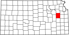 | |
| CDP | ||
| Unincorporated communities | ||
| Townships |
| |