Valsamoggia
| Valsamoggia | |
|---|---|
| Comune | |
| Comune di Valsamoggia | |
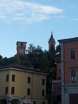 A view of Bazzano. | |
 Valsamoggia Location of Valsamoggia in Italy | |
| Coordinates: 44°30′11″N 11°05′11″E / 44.50306°N 11.08639°E | |
| Country | Italy |
| Region | Emilia-Romagna |
| Metropolitan city | Bologna (BO) |
| Frazioni | Bazzano (communal seat), Bersagliera, Bortolani, Calcara, Castello di Serravalle, Crespellano, Fagnano, Maiola, Mercatello, Merlano, Montebudello, Monteveglio, Ponzano, Rodiano, Samoggia, San Biagio, San Prospero, Santa Croce, Savigno, Serravalle, Stiore-Oliveto, Tiola, Vedegheto, Vignola dei Conti, Zappolino, Ziribega |
| Government | |
| • Mayor | Daniele Ruscigno |
| Area | |
| • Total | 178,13 km2 (6,878 sq mi) |
| Elevation | 182 m (597 ft) |
| Population (30 November 2017)[1] | |
| • Total | 30,886 |
| • Density | 1.7/km2 (4.5/sq mi) |
| Demonym(s) | Samodiani |
| Time zone | UTC+1 (CET) |
| • Summer (DST) | UTC+2 (CEST) |
| Postal code | 40050 |
| Dialing code | 051 |
| Patron saint | St. John XXIII |
| Saint day | 11 October |
| Website | Official website |
Valsamoggia (Bolognese: Valsamûz) is a comune in the Metropolitan City of Bologna, Emilia-Romagna, Italy. It was created on 1 January 2014 after the merger of the former communes of Bazzano (the current town hall seat), Castello di Serravalle, Crespellano, Monteveglio and Savigno.
The frazione of Zappolino in the Middle Ages was the location of a battle between the communes of Modena and Bologna.
References

This article is issued from
Wikipedia.
The text is licensed under Creative Commons - Attribution - Sharealike.
Additional terms may apply for the media files.