Utica, Mississippi
| Utica, Mississippi | |
|---|---|
| Town | |
 Lebanon Presbyterian Church, a historic church in Utica, Mississippi | |
 Location of Utica, Mississippi | |
 Utica, Mississippi Location in the United States | |
| Coordinates: 32°6′12″N 90°37′20″W / 32.10333°N 90.62222°WCoordinates: 32°6′12″N 90°37′20″W / 32.10333°N 90.62222°W | |
| Country | United States |
| State | Mississippi |
| County | Hinds |
| Government | |
| • Type | Mayor-Council |
| • Mayor | Kenneth Broome |
| Area | |
| • Total | 3.00 sq mi (7.78 km2) |
| • Land | 3.00 sq mi (7.76 km2) |
| • Water | 0.008 sq mi (0.02 km2) |
| Elevation | 295 ft (90 m) |
| Population (2010) | |
| • Total | 820 |
| • Estimate (2016)[1] | 869 |
| • Density | 274/sq mi (105.7/km2) |
| Time zone | UTC-6 (Central (CST)) |
| • Summer (DST) | UTC-5 (CDT) |
| ZIP code | 39175 |
| Area code(s) | 601 |
| FIPS code | 28-75760 |
| GNIS feature ID | 0679161 |
Utica is a town in Hinds County, Mississippi, United States. The population was 820 at the 2010 census,[2] down from 966 at the 2000 census. Utica is part of the Jackson Metropolitan Statistical Area.
History
Utica was originally an area known as Cane Ridge.[3] In 1837, it was given the name Utica at the suggestion of the then postmaster, Ozias Osborn, who came from Utica, New York.[4] The town was incorporated in 1880.
Utica was located on the Yazoo and Mississippi Valley Railroad. A weekly newspaper, the Herald, was established in 1897. In the early 1900s, Utica had several churches, eight hotels, a public school for white students, and an industrial college for black students. Agriculture consisted of watermelons, cotton and timber. The settlement had a sawmill, three cotton gins, and a brick plant. The population in 1907 was nearly 1,000.[5]
Geography
Utica is in southwest Hinds County at the junctions of Mississippi Highways 18 and 27. Highway 18 leads northeast 32 miles (51 km) to Jackson, the state capital, and southwest 28 miles (45 km) to Port Gibson, while Highway 27 leads northwest 25 miles (40 km) to Vicksburg and southeast 20 miles (32 km) to Crystal Springs.
According to the United States Census Bureau, Utica has a total area of 3.0 square miles (7.8 km2), of which 0.01 square miles (0.02 km2), or 0.25%, are water.[2]
Climate
The climate in this area is characterized by relatively high temperatures and evenly distributed precipitation throughout the year. According to the Köppen Climate Classification system, Utica has a humid subtropical climate, abbreviated "Cfa" on climate maps.[6]
| Climate data for Utica, Mississippi | |||||||||||||
|---|---|---|---|---|---|---|---|---|---|---|---|---|---|
| Month | Jan | Feb | Mar | Apr | May | Jun | Jul | Aug | Sep | Oct | Nov | Dec | Year |
| Average high °C (°F) | 16 (60) |
17 (63) |
21 (70) |
25 (77) |
29 (84) |
33 (91) |
33 (92) |
34 (93) |
32 (89) |
27 (80) |
21 (69) |
16 (61) |
25 (77) |
| Average low °C (°F) | 3 (38) |
4 (40) |
8 (46) |
12 (53) |
16 (60) |
19 (67) |
21 (70) |
21 (70) |
18 (64) |
12 (53) |
7 (44) |
4 (39) |
12 (54) |
| Average precipitation mm (inches) | 122 (4.8) |
119 (4.7) |
142 (5.6) |
132 (5.2) |
119 (4.7) |
104 (4.1) |
122 (4.8) |
89 (3.5) |
69 (2.7) |
64 (2.5) |
91 (3.6) |
132 (5.2) |
1,308 (51.5) |
| Source: Weatherbase [7] | |||||||||||||
Demographics
| Historical population | |||
|---|---|---|---|
| Census | Pop. | %± | |
| 1880 | 230 | — | |
| 1890 | 370 | 60.9% | |
| 1900 | 540 | 45.9% | |
| 1910 | 572 | 5.9% | |
| 1920 | 445 | −22.2% | |
| 1930 | 652 | 46.5% | |
| 1940 | 818 | 25.5% | |
| 1950 | 824 | 0.7% | |
| 1960 | 764 | −7.3% | |
| 1970 | 1,019 | 33.4% | |
| 1980 | 1,064 | 4.4% | |
| 1990 | 1,033 | −2.9% | |
| 2000 | 966 | −6.5% | |
| 2010 | 820 | −15.1% | |
| Est. 2016 | 869 | [1] | 6.0% |
| U.S. Decennial Census[8] | |||
As of the 2010 United States Census, there were 820 people residing in the town. The racial makeup of the town was 64.0% Black, 26.8% White, 0.1% Native American, 0.2% from some other race and 0.1% from two or more races. 8.7% were Hispanic or Latino of any race.
As of the census[9] of 2000, there were 966 people, 339 households, and 241 families residing in the town. The population density was 323.0 people per square mile (124.7/km²). There were 397 housing units at an average density of 132.7 per square mile (51.3/km²). The racial makeup of the town was 30.54% White, 66.36% African American, 0.10% Native American, 0.31% Asian, 2.07% from other races, and 0.62% from two or more races. Hispanic or Latino of any race were 3.83% of the population.
There were 339 households out of which 29.5% had children under the age of 18 living with them, 37.8% were married couples living together, 27.4% had a female householder with no husband present, and 28.9% were non-families. 26.0% of all households were made up of individuals and 15.0% had someone living alone who was 65 years of age or older. The average household size was 2.85 and the average family size was 3.43.
In the town, the population was spread out with 28.8% under the age of 18, 11.7% from 18 to 24, 24.8% from 25 to 44, 18.3% from 45 to 64, and 16.4% who were 65 years of age or older. The median age was 32 years. For every 100 females there were 94.4 males. For every 100 females age 18 and over, there were 85.9 males.
The median income for a household in the town was $27,614, and the median income for a family was $30,083. Males had a median income of $28,594 versus $21,932 for females. The per capita income for the town was $11,491. About 17.1% of families and 27.1% of the population were below the poverty line, including 37.1% of those under age 18 and 24.5% of those age 65 or over.
Religion and society
Utica is the location of the URJ Henry S. Jacobs Camp, organized by the Union for Reform Judaism and dating to when there were more Jews in smaller communities in Mississippi. Most now live in larger urban areas with more professional opportunities.
The town is home to several churches of various denominations, including the following on Main Street: Utica Baptist Church (founded in 1829 and affiliated with the Southern Baptist Convention), Utica Christian Church (Disciples of Christ), Utica United Methodist Church, and St. Peter's Missionary Baptist Church, a black Baptist church founded in 1867 after the war by freedmen as a mission of the Baptist church. The black Baptists mostly withdrew en masse across the South from the white Baptist churches. They soon founded independent state associations of their congregations in the South, organizing a national convention by the end of the century. There are several other houses of worship in the town proper, as well as others in the county.
Education
Utica is served by the Hinds County School District. It is also the home of the Utica campus of Hinds Community College. Formerly Utica Junior College, the school was founded in 1903 as Utica Normal and Industrial Institute. It was previously home to Hinds County Agricultural High School.
Notable person
- Derek Newton, offensive lineman for Houston Texans
- Alonzo Bradley who played for Texas Southern University and who was the MVP of the 1977 NAIA basketball championship.
References
- 1 2 "Population and Housing Unit Estimates". Retrieved June 9, 2017.
- 1 2 "Geographic Identifiers: 2010 Census Summary File 1 (G001): Utica town, Mississippi". American Factfinder. U.S. Census Bureau. Retrieved August 17, 2017.
- ↑ Mary Collins Landin, "Utica," Hinds County Mississippi MSGenWeb (Page Created July 3, 2005)
- ↑ Mary Collins Landin, "Utica Baptist Church Celebrates 175th Anniversary, 1825-2004," SARRETT/SARRATT/SURRATT Families of America (SFA) (website)
- ↑ Rowland, Dunbar (1907). Mississippi: Comprising Sketches of Counties, Towns, Events, Institutions, and Persons, Arranged in Cyclopedic Form. 2. Southern Historical Publishing Association. p. 846.
- ↑ Climate Summary for Utica, Mississippi
- ↑ "Weatherbase.com". Weatherbase. 2013. Retrieved on September 21, 2013.
- ↑ "Census of Population and Housing". Census.gov. Retrieved June 4, 2015.
- ↑ "American FactFinder". United States Census Bureau. Retrieved 2008-01-31.
| Wikimedia Commons has media related to Utica, Mississippi. |
Municipalities and communities of Hinds County, Mississippi, United States | ||
|---|---|---|
| Cities | 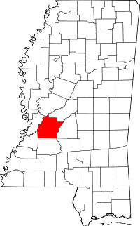 | |
| Towns | ||
| Unincorporated communities | ||
| Footnotes | ‡ This populated place also has portions in an adjacent county or counties | |