Upper Musquodoboit, Nova Scotia
| Upper Musquodoboit | |
|---|---|
| Village | |
 Upper Musquodoboit | |
 Upper Musquodoboit | |
| Coordinates: 45°05′N 62°34′W / 45.08°N 62.57°WCoordinates: 45°05′N 62°34′W / 45.08°N 62.57°W | |
| Country |
|
| Province |
|
| Area | |
| • Total | 380.25 km2 (146.82 sq mi) |
| Population (2006) | |
| • Total | 473 |
| Time zone | AST |
| Area code(s) | 902 |
| Telephone exchange | 902-568 |
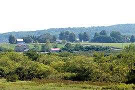
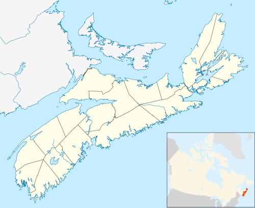
Upper Musquodoboit is a forestry and farming community in the northeastern reaches of the Musquodoboit Valley, in the Halifax Regional Municipality, Nova Scotia, Canada, 75 kilometres (47 mi) from Downtown Halifax. The community is located along the Musquodoboit River. The community had a population of 473 at the 2006 Census and the community has an area of 380.25 square kilometres (146.82 sq mi). Upper Musquodoboit is situated at the junction of Route 336 with Route 224.
Upper Musquodoboit Elementary School is the only school in the community. It teaches grades primary through six, and was built in 1962. As of 2017, there are 27 students enrolled in the school.[1] For children whom are grade seven or higher, they go to Musquodoboit Rural High School (MRHS) for school.[2] Upper Musquodoboit also has a convenience store,[3] an auto-body shop[4] and a limestone mine, named Mosher Limestone.[5]
Places adjacent to Upper Musquodoboit, Nova Scotia | ||||||||||
|---|---|---|---|---|---|---|---|---|---|---|
| ||||||||||
References
- ↑ "Upper Musquodoboit Consolidated Elem". Halifax Regional School Board. Retrieved 4 April 2016.
- ↑ "Musquodoboit Rural High". Halifax Regional School Board. Retrieved 4 April 2016.
- ↑ "Upper Musquodoboit Mini Mart". Yellow Pages Digital & Media Solutions Limited. Retrieved 4 April 2016.
- ↑ "Atwood's Autobody & Garage". Yellow Pages Digital & Media Solutions Limited. Retrieved 4 April 2016.
- ↑ "Mosher Limestone". Mosher Limestone Co. Ltd. Retrieved 4 April 2016.
| Government | |
|---|---|
| Services and agencies | |
| Articles of interest | |
| Education | |
| Major neighbourhoods & communities |
|
| |