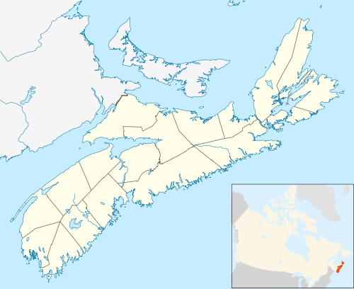
Timberlea, Nova Scotia
Timberlea is a community located on the rural/suburban fringe of the Halifax Regional Municipality in Nova Scotia, Canada, along the St. Margaret's Bay Rd (Nova Scotia Trunk 3), which extends from the Armdale Rotary to the Head of St. Margaret's Bay. It begins about 8 miles/13 km from downtown Halifax. The name means a broad meadow in a forest.
Timberlea is a part of the Timberlea-Prospect provincial electoral district. Iain Rankin of the Nova Scotia Liberal Party has been the member of the Legislative Assembly since 2013.[1] Timberlea is part of District 12 which is represented at city hall by Councillor Richard Zurawski since 2016.[2] It is a part of the "Beechville-Lakeside-Timberlea" (BLT) area, and is bounded on the side closer to Halifax by Lakeside, and on the other side (at exit 4 on the 103 highway) by Hubley.
History
The community was first known as Nine Mile River after the river in the centre of the community which fed several early mills. The St. Margaret's Bay Road was routed through the village in the mid 19th century, relocated from an earlier location further south. Several hotels were established to cater to travelers and later sportsmen and the Nine Mile River was crossed by an arched stone bridge which survived until 2014 as one of the only surviving stone bridges in Nova Scotia. After the arrival of the Halifax and Southwestern Railway in 1904, the community was referred to as Bowser's Station, after Angus Bowser, who ran a hotel near the area's train station near present-day Greenwood Heights. It was renamed Timberlea in 1922 to reflect the importance of the forest and lumbering.[3] Aubrey Fraser was an early settler in the area, and he, his father and brothers stationed a saw mill along the Nine Mile River. Almost a decade following the Halifax Explosion, the Bowser's Hotel was sold to Mr. and Mrs. William Miller. It had been a frequent stop for people traveling along the St. Margaret's Bay Road, between Halifax and Yarmouth. The Hotel was leveled in a fire on the night of December 12, 1947. Until the early 1990s, the community was a semi-rural, fairly close-knit community. Subsequently, several large developments such as Greenwood Heights have substantially increased the population, and it is now mostly a suburban community.
Geography
Timberlea is fairly flat on the northern side of the St. Margaret's Bay Road and the topography rises on the southern side to the 103 Highway. The community is situated mostly within the watershed of Nine Mile River, which empties into Shad Bay, near Peggy's Cove on the St. Margaret's Bay. The western portion of Governor's Lake, and all of Fraser's Lake are with the community. The flora is predominantly softwood and mixed Boreal Forest, and the bedrock is granite throughout, with many outcrops including several areas of barrens which offer good blueberry and huckleberry picking.
Recreational opportunities
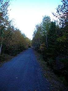
The area has good out-door recreational facilities and opportunities. The Beechville Lakeville Timberlea (BLT) Rails to Trails Association (see link below) has turned its 13 kilometres (8.1 mi) of the old Halifax and Southwestern Railway bed from Beechville to Hubley into a hiking/cycling/ATV rail trail which connects with a similar 32 kilometres (20 mi) stretch maintained by the similar St. Margaret's Bay organization.
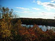
The Bluff Trail, a 30 kilometres (19 mi)network of non-motorized wilderness trails, branches off the BLT Trail at Cranberry Lake. Swimming is available at Governor's Lake and, if a good community access point can be re-established on Fraser's Lake, which offers opportunities for kayaking and canoeing. There are tennis and basketball courts and a ball diamond in Greenwood Heights, several basketball nets and a well-build playground at the BLT Elementary School, and tennis courts and a skateboard facility at the Lakeside Community Center. Indoor recreation programs are run year-round at this center as well.
Contemporary issues
There is discussion over preserving a substantially large area of crown land for a park near the lakes. Tentative plans are being discussed over the prospect of a community library, and construction and restoration of a "Fraser's Mill Museum", commemorating the saw mill at the source of Nine Mile River, which was once owned by the Fraser family. Loss of wilderness area and increasing suburban burdens have also fed opposition to Highway 113, a proposed highway connector from Timberlea.[4] Currently, Timberlea can be considered a "bedroom community", since there are a very limited number of business and services in the immediate area.
Demography
Newspaper
The BLT Insider monthly newspaper serves Beechville, Lakeside Timberlea and surrounding communities. Combining local news, sports and features that support the region’s reliable local advertising source.[7]
Amenities
Timberlea is home to Beechville-Lakeside-Timberlea Elementary School which serves those three communities. The school is located between the Glengarry Estates and Greenwood Heights subdivisions.
In early 2018 it was announced Sobeys would open a new store at Exit 103 to service Timberlea.[8]
References
| Wikimedia Commons has media related to Timberlea, Nova Scotia. |
- ↑ "Timberlea-Prospect: Iain Rankin (Liberal)" The Nova Scotia Legislature. Retrieved May 22, 2014.
- ↑ "Councillor Richard Zurawski". Retrieved 2018-04-22.
- ↑ Alfreda Withrow, One City, Many Communities, Nimbus Publishing, Halifax (1999), p. 169
- ↑ Tim Bousquet, "Province still dedicated to highway construction", The Coast, September 3, 2009.
- ↑ "Beechville Lakeside Timberlea Jr Elementary | Halifax Regional Centre for Education". www.hrsb.ca. Retrieved 2018-04-22.
- ↑ "Beechville Lakeside Timberlea Sr Elementary | Halifax Regional Centre for Education". www.hrsb.ca. Retrieved 2018-04-22.
- ↑ http://www.bltinsider.ca/
- ↑ "A New Sobeys, Thai Express Sackville * Halifax ReTales". Halifax ReTales. 2018-02-18. Retrieved 2018-07-29.
Coordinates: 44°39′20.5″N 63°44′4.6″W / 44.655694°N 63.734611°W
| Government | |
|---|---|
| Services and agencies | |
| Articles of interest | |
| Education | |
| Major neighbourhoods & communities |
|
| |