Upper Caldecote
| Upper Caldecote | |
|---|---|
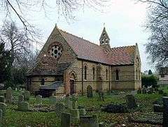 All Saints' Church, Upper Caldecote | |
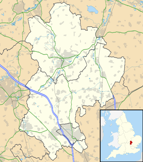 Upper Caldecote Upper Caldecote shown within Bedfordshire | |
| OS grid reference | TL167459 |
| Civil parish | |
| Unitary authority | |
| Ceremonial county | |
| Region | |
| Country | England |
| Sovereign state | United Kingdom |
| Post town | BIGGLESWADE |
| Postcode district | SG18 |
| Dialling code | 01767 |
| Police | Bedfordshire |
| Fire | Bedfordshire and Luton |
| Ambulance | East of England |
| EU Parliament | East of England |
| UK Parliament | |
Upper Caldecote is a village in the Central Bedfordshire district of Bedfordshire, England. It forms part of Northill civil parish. The nearest town is Biggleswade.
Most of Upper Caldecote is situated directly to the west of the A1 road, with facilities including Caldecote Lower School, a post office, Anglican church, Methodist chapel, antiques shop, garage, G&M Growers, cricket club, football pitches and changing rooms, tennis courts, netball court, children's park and two newsagents.
The Anglican church of All Saints was built in 1867–8, in yellow brick with red brick banding and dressings, to designs of Arthur Blomfield.[1]
See also
References
- ↑ Historic England. "Church of All Saints, Upper Caldecote (1274788)". National Heritage List for England. Retrieved 20 August 2018.
External links

- Upper Caldecote history pages
- Caldecote Playing Fields Association
- Caldecote Cricket Club
- Caldecote Netball Club
This article is issued from
Wikipedia.
The text is licensed under Creative Commons - Attribution - Sharealike.
Additional terms may apply for the media files.