Kentucky's 5th congressional district
| Kentucky's 5th congressional district | |
|---|---|
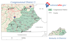
.tif.png) Kentucky's 5th congressional district - since January 3, 2013. | |
| Current Representative | Hal Rogers (R–Somerset) |
| Distribution |
|
| Population (2016) | 703,315[2] |
| Median income | $30,585 |
| Ethnicity |
|
| Cook PVI | R+31[3] |
Kentucky's 5th congressional district is a congressional district in the U.S. state of Kentucky. Located in the heart of Appalachia in Southeastern Kentucky, the rural district is one of the most impoverished districts in the nation and, as of the 2010 U.S. Census, it has the highest percentage of White Americans in the nation. Located within the district are the economic leading cities of Pikeville, Prestonsburg, Middlesborough, Hazard, Jackson, Morehead, Ashland, London, Somerset.
The current 5th congressional district is one of the few ancestrally Republican regions south of the Ohio River. Much of the region now in the district strongly supported the Union in the Civil War, and identified with the Republicans after hostilities ceased. Much of the eastern portion of the district was once part of the disbanded 7th congressional district, long a Democratic stronghold. The 7th district was disbanded in 1992 after the 1990 census showed that the state's population could no longer support seven districts. Geographically, the district consists of flat land areas to the west, to Appalachia highland mountains to the east and southeast. To the north to northeast of the district are rolling hills that end at the Ohio River.
The district is currently represented by Republican Harold D. "Hal" Rogers, the dean of the Kentucky delegation. Congressman Rogers currently serves in various top leadership positions in the U.S. House of Representatives.
Characteristics
As of September 2013, there were 510,329 registered voters: 253,798 (49.73%) Democrats, 235,470 (46.14%) Republicans, and 21,061 (4.13%) "Others". All of the "Others" included 15,344 (3.01%) unclassified Others, 5,385 (1.06%) Independents, 241 (0.05%) Libertarians, 43 (0.0084%) Greens, 21 (0.0041%) Constitutionalists, 20 (0.0039%) Reforms, and 7 (0.0014%) Socialist Workers.[4][5]
Until January 1, 2006, Kentucky did not track party affiliation for registered voters who were neither Democratic nor Republican.[6] The Kentucky voter registration card does not explicitly list anything other than Democratic Party, Republican Party, or Other, with the "Other" option having a blank line and no instructions on how to register as something else.[7]
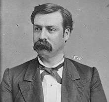
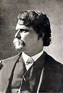
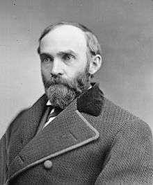
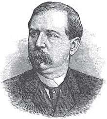
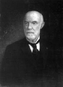
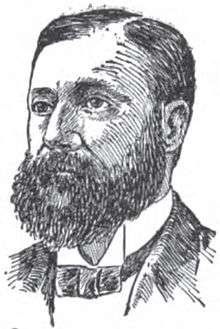
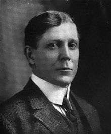
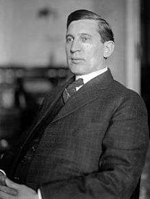
List of representatives
| Representative | Party | Years | Note |
|---|---|---|---|
District created |
March 4, 1803 | ||
 | March 4, 1803 – March 3, 1807 | Redistricted from the 2nd district | |
 | March 4, 1807 – April 10, 1810 | Resigned to become Governor of Louisiana Territory | |
 | August 8, 1810 – March 3, 1811 | ||
 | March 4, 1811 – March 3, 1813 | Redistricted to the 2nd district | |
 | March 4, 1813 – March 3, 1815 | ||
 | March 4, 1815 – March 3, 1817 | ||
| March 4, 1817 – March 3, 1819 | ||
| March 4, 1819 – March 3, 1821 | ||
| March 4, 1821 – March 3, 1823 | ||
 | March 4, 1823 – March 3, 1825 | Redistricted from the 3rd district | |
 | March 4, 1825 – August 13, 1826 | Died | |
| December 7, 1826 – March 3, 1829 | ||
 | March 4, 1829 – March 3, 1833 | Redistricted to the 13th district | |
 | August 6, 1834 – March 3, 1835 | House declared new election after election was contested | |
| March 4, 1835 – March 3, 1837 | ||
| March 4, 1837 – March 3, 1839 | |||
 | March 4, 1839 – August 11, 1840 | Died | |
 | December 7, 1840 – March 3, 1843 | ||
| March 4, 1843 – March 3, 1845 | ||
| March 4, 1845 – March 3, 1847 | ||
| March 4, 1847 – March 3, 1851 | ||
| March 4, 1851 – March 3, 1853 | ||
| March 4, 1853 – March 3, 1855 | ||
 | March 4, 1855 – March 3, 1859 | ||
 | December 3, 1860 – March 3, 1861 | Did not take seat until 2nd session because did not meet age requirement for office | |
 | March 4, 1861 – March 3, 1863 | ||
 | March 4, 1863 – March 3, 1865 | Redistricted from the 7th district | |
 | March 4, 1863 – July 21, 1866 | Resigned | |
| December 3, 1866 – March 3, 1867 | Re-elected to seat | |
 | March 4, 1867 – March 3, 1869 | ||
 | March 4, 1869 – March 3, 1873 | ||
 | March 4, 1873 – March 3, 1875 | ||
 | March 4, 1875 – July 8, 1876 | Died | |
 | August 12, 1876 – March 3, 1877 | ||
 | March 4, 1877 – March 3, 1887 | ||
 | March 4, 1887 – March 3, 1895 | ||
 | March 4, 1895 – March 3, 1899 | ||
| March 4, 1899 – March 3, 1901 | ||
 | March 4, 1901 – March 3, 1903 | ||
 | March 4, 1903 – March 3, 1919 | ||
 | March 4, 1919 – March 3, 1923 | ||
 | March 4, 1923 – March 3, 1933 | ||
| District redistricted to at-large district | March 4, 1933 | ||
| District re-established from at-large district | January 3, 1935 | ||
 | January 3, 1935 – January 3, 1963 | Redistricted from the At-large district | |
 | January 3, 1963 – January 3, 1965 | Redistricted from the 8th district | |
 | January 3, 1965 – January 3, 1981 | ||
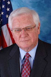 | January 3, 1981 – Present | Incumbent | |
Recent election results
2002
| Party | Candidate | Votes | % | |
|---|---|---|---|---|
| Republican | Hal Rogers* | 137,986 | 78.29 | |
| Democratic | Sidney Jane Bailey | 38,254 | 21.71 | |
| Total votes | 176,240 | 100.00 | ||
| Turnout | ||||
| Republican hold | ||||
2004
| Party | Candidate | Votes | % | |
|---|---|---|---|---|
| Republican | Hal Rogers* | 177,579 | 100.00 | |
| Total votes | 177,579 | 100.00 | ||
| Turnout | ||||
| Republican hold | ||||
2006
| Party | Candidate | Votes | % | |
|---|---|---|---|---|
| Republican | Hal Rogers* | 147,261 | 73.76 | |
| Democratic | Kenneth Stepp | 52,384 | 26.24 | |
| Total votes | 199,645 | 100.00 | ||
| Turnout | ||||
| Republican hold | ||||
2008
| Party | Candidate | Votes | % | |
|---|---|---|---|---|
| Republican | Hal Rogers* | 177,024 | 84.11 | |
| Independent | Jim Holbert | 33,444 | 15.89 | |
| Total votes | 210,468 | 100.00 | ||
| Turnout | ||||
| Republican hold | ||||
2010
| Party | Candidate | Votes | % | |
|---|---|---|---|---|
| Republican | Hal Rogers* | 151,019 | 77.43 | |
| Democratic | Jim Holbert | 44,034 | 22.58 | |
| Total votes | 195,053 | 100.00 | ||
| Turnout | ||||
| Republican hold | ||||
2012
| Party | Candidate | Votes | % | |
|---|---|---|---|---|
| Republican | Hal Rogers* | 195,408 | 77.90 | |
| Democratic | Kenneth S. Stepp | 55,447 | 22.10 | |
| Total votes | 250,855 | 100.00 | ||
| Turnout | ||||
| Republican hold | ||||
2014
| Party | Candidate | Votes | % | |
|---|---|---|---|---|
| Republican | Hal Rogers* | 171,350 | 78.30 | |
| Democratic | Kenneth S. Stepp | 47,617 | 21.70 | |
| Total votes | 218,967 | 100.00 | ||
| Turnout | ||||
| Republican hold | ||||
Voting
Election results from presidential races:
| Year | Office | Results |
|---|---|---|
| 2000 | President | George W. Bush 57 - Al Gore 42% |
| 2004 | President | George W. Bush 61 - John Kerry 39% |
| 2008 | President | John McCain 67 - Barack Obama 31% |
| 2012 | President | Mitt Romney 75 - Barack Obama 23% |
| 2016 | President | Donald Trump 80 - Hillary Clinton 17% |
Historical district boundaries
See also
References
- ↑ Geography, US Census Bureau. "Congressional Districts Relationship Files (state-based)". www.census.gov. Retrieved 9 April 2018.
- ↑ Bureau, Center for New Media & Promotion (CNMP), US Census. "My Congressional District". www.census.gov. Retrieved 9 April 2018.
- ↑ "Partisan Voting Index – Districts of the 115th Congress" (PDF). The Cook Political Report. April 7, 2017. Retrieved April 7, 2017.
- ↑ "Registration Statistics: By Congression District". Kentucky State Board of Elections. September 2013. Retrieved 2014-02-06.
- ↑ "Registration Statistics: Other Political Organizations and Groups". Kentucky State Board of Elections. September 2013. Retrieved 2014-02-06.
- ↑ "Kentucky Administrative Regulations 31KAR4:150". Kentucky Legislative Research Commission. November 2005. Retrieved 2014-02-06.
- ↑ "Register To Vote". Kentucky State Board of Elections. August 2003. Retrieved 2014-02-06.
- Martis, Kenneth C. (1989). The Historical Atlas of Political Parties in the United States Congress. New York: Macmillan Publishing Company.
- Martis, Kenneth C. (1982). The Historical Atlas of United States Congressional Districts. New York: Macmillan Publishing Company.
- Congressional Biographical Directory of the United States 1774–present
Coordinates: 37°22′08″N 83°31′19″W / 37.36889°N 83.52194°W