Umm Salamuna
| Umm Salamuna | |
|---|---|
| Other transcription(s) | |
| • Arabic | خربة ام سلمونه |
| • Also spelled |
Um Salmonah (official) Kirbat Umm Salamunah (unofficial) |
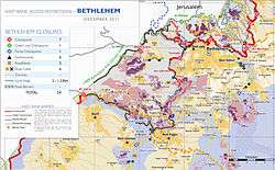 Area map, showing Umm Salamunu, north of Beit Fajjar, in 2011 | |
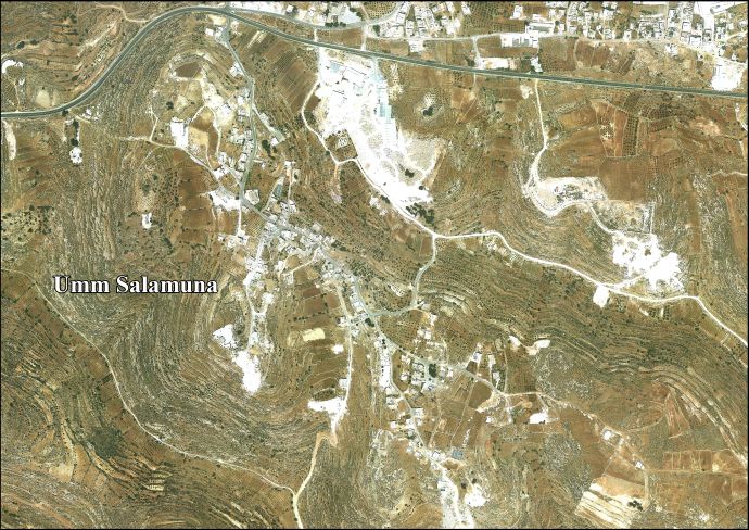
 Umm Salamuna Location of Umm Salamuna within Palestine | |
| Coordinates: 31°38′36″N 35°10′05″E / 31.64333°N 35.16806°ECoordinates: 31°38′36″N 35°10′05″E / 31.64333°N 35.16806°E | |
| Palestine grid | 166/116 |
| Governorate | Bethlehem |
| Government | |
| • Type | Village council |
| Population (2007) | |
| • Jurisdiction | 945 |
| Name meaning | Umm Salamôni, the ruin of the mother of Salamôni[1] |
Umm Salamuna (Arabic: خربة ام سلمونه) is a Palestinian village located twelve kilometers South-west of Bethlehem. The village is in the Bethlehem Governorate in the southern West Bank. According to the Palestinian Central Bureau of Statistics, the village had a population of 945 in 2007.[2] The primary healthcare is obtained in Beit Fajjar where the Ministry of Heath have classified the care facilities as level 3.[3]
History
Ottoman era
In 1883, the Palestine Exploration Fund's Survey of Western Palestine noted "Heaps of stones" at Kh. Umm Salamôni.[4]
British Mandate era
In the 1931 census the population of Umm Salamuna was counted together with Beit Fajjar, Marah Ma'alla and Marah Rabah. The total population was 1043, all Muslims, in 258 houses.[5]
Jordanian era
In the wake of the 1948 Arab–Israeli War, Umm Salamuna came under Jordanian rule.
In 1961, the population was 118.[6]
Post-1967
Since the Six-Day War in 1967, Umm Salamuna has been under Israeli occupation.
Footnotes
- ↑ Palmer, 1881, p. 403
- ↑ 2007 PCBS Census Palestinian Central Bureau of Statistics. p.118.
- ↑ West Bank Healthcare
- ↑ Conder and Kitchener, 1883, SWP III, p. 371
- ↑ Mills, 1932, p. 35
- ↑ Government of Jordan, Department of Statistics, 1964, p. 23
Bibliography
- Conder, C.R.; Kitchener, H. H. (1883). The Survey of Western Palestine: Memoirs of the Topography, Orography, Hydrography, and Archaeology. 3. London: Committee of the Palestine Exploration Fund.
- Government of Jordan, Department of Statistics (1964). First Census of Population and Housing. Volume I: Final Tables; General Characteristics of the Population (PDF).
- Mills, E., ed. (1932). Census of Palestine 1931. Population of Villages, Towns and Administrative Areas. Jerusalem: Government of Palestine.
- Palmer, E. H. (1881). The Survey of Western Palestine: Arabic and English Name Lists Collected During the Survey by Lieutenants Conder and Kitchener, R. E. Transliterated and Explained by E.H. Palmer. Committee of the Palestine Exploration Fund.
External links
- Welcome To Khirbat Umm Salamunah
- Survey of Western Palestine, Map 21: IAA, Wikimedia commons
- West Bank road closures
- Um Salamuna village (fact sheet), Applied Research Institute–Jerusalem (ARIJ)
- Umm Salamuna village profile, ARIJ
- Um Salamuna aerial photo, ARIJ
- The priorities and needs for development in Umm Salamuna village based on the community and local authorities’ assessment, ARIJ
| Cities |  | |
|---|---|---|
| Municipalities | ||
| Villages |
| |
| Refugee camps | ||
| Other | ||