Uklana Mandi
| Uklana Mandi उकलाना मंडी | |
|---|---|
| city | |
 Uklana Mandi Location in Haryana, India  Uklana Mandi Uklana Mandi (India) | |
| Coordinates: 29°31′00″N 75°52′00″E / 29.5167°N 75.8667°ECoordinates: 29°31′00″N 75°52′00″E / 29.5167°N 75.8667°E | |
| Country |
|
| State | Haryana |
| District | Hisar |
| Population (2011) | |
| • Total | 13,219 |
| Languages | |
| • Official | Hindi |
| Time zone | UTC+5:30 (IST) |
| PIN | 125113 |
| Telephone code | +911693 |
| Vehicle registration | HR 80, HR 20, HR 39 |
| Website | http://www.uklana.in |
Uklana Mandi (Hindi: उकलाना मंडी), (Urdu: اُکھلانا منڈی ), is a city, municipal committee and Uklana (Vidhan Sabha constituency), in Hisar district in the Indian state of Haryana. The city supplies grains to thousands of local traders and rest of the country.
Uklanamandi has three suburbs: Latani, Parbhuwala and Daulatpur.
Etymology
Uklanamandi is a well-known and chief grain market yard, situated in Haryana. In one the Indian languages, mandi means a place to sell. It is unclear if the name of the city gave rise to the term or vice versa.
History
Uklana Mandi is a prominent market region, which was licensed as Agriculture Product Marketing Centre in Haryana.[1]
Education
Geography
Climate
Uklana features a typical version of the humid subtropical climate. Summers are long and extremely hot, from early April to mid-October, with the monsoon season in between. The months of March to May see a time of hot prickling heat. Monsoon arrives at the end of June, bringing some respite from the heat, but increasing humidity at the same time. The brief, mild winter starts in late November and peaks in January and is notorious for its heavy fog. Extreme temperatures range from −0.6 °C (30.9 °F) to 46.7 °C (116.1 °F).
Location
Uklana is located at 29.5167°N 75.8667°E. It has an average elevation of 209 metres.
Demographics
Hindus constitute the bulk of population followed byJaats, Jains, Sikhs, Muslims, and Christians. Arya Samaj flourished in the city long time ago
Amenities
Education
There are number of schools in the city affiliated either to State board or Central board.
- Government College, Uklana
Utilities and Services
The water supply in Uklana is managed by its Jal Board and is very well managed. Electric supply undertaking is managed by the DHBVN. BSNL provides tele-services for landline and mobile and many other services. Many private telecom operators are also offering their services in the city as Vodafone Essar, Airtel, Idea, Reliance, Tata, MTS, Aircel etc. Utility services are well managed including water supplies, irrigation and agriculture, banking. Medical services are served by a Civil Hospital and private hospitals.
Transportation
Uklana is well connected with railway and road network as it is connected with NH 52. Haryana Roadways buses connect it with most of the destinations. Buses are available in day hours and also in night hours but in rare numbers.
Airports
Nearest Airports to Uklana are of Hisar, Chandigarh, Patiala and Delhi. Delhi’s Airport is very well connected to the world map and Indian states and territories. A few private companies also provide charted flights from Sirsa, which is 2 hours distance by road.
Web Site
http://www.uklana.in - Uklana City Portal
Web Site Office Nawal Mobile & Electronics, Uklana Mandi.
References
- ↑ www.Uklana.in
- ↑ 24 new Govt colleges to come up in Haryana: Sharma , The Pioneer, 23 Jan 2017.]
- ↑ 22 new government colleges for Haryana, 13 Oct 2016.
Hisar district topics | ||
|---|---|---|
| Cities and towns | 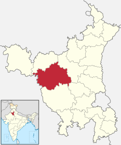 | |
| Education | ||
| Economy | ||
| Transport | ||
| Lok Sabha constituencies | ||