Barwala, Hisar
| Barwala बरवाला | |
|---|---|
| city | |
 Barwala Location in Haryana, India  Barwala Barwala (India) | |
| Coordinates: 29°23′N 75°55′E / 29.38°N 75.92°ECoordinates: 29°23′N 75°55′E / 29.38°N 75.92°E | |
| Country |
|
| State | Haryana |
| District | Hisar |
| Government | |
| • Body | Tehsil |
| Elevation | 214 m (702 ft) |
| Population (2001) | |
| • Total | 89,000 |
| Languages | |
| • Official | Hindi |
| Time zone | UTC+5:30 (IST) |
| Telephone code | 01693 |
| ISO 3166 code | IN-HR |
| Vehicle registration | HR 80 |
| Website |
haryana |
Barwala (Hindi: बरवाला) (Urdu: بَروالا ), is a town and municipal committee in Hisar district of the state of Haryana, India.[1]
Geography
Barwala is located at map location of Barwala. It has an average elevation of 214 metres (702 feet).
Demographics
As of 2001 India census, Barwala had a population of 43,384. Males constitute 52.5% of the population and females 47.5%. Barwala has an average literacy rate of 63.5%, above than the national average of 59.5%; with 55% of the males and 45% of females literate. 8.5% of the population is under 6 years of age.
Education
History
Barwala was located in the honour of the king Raja Barwala.After his name the barwala city was named. In the 19th century there was the kingdom of Muslims. After firing of tank attacks from village Dhani Khan Bahadur with the lead crystal they were defeated to run away to Pakistan.
Barwala is home to the Satlok ashram of Rampal. In November 2014, thousands of his followers gathered around his ashram to prevent the police from arresting him. Around 200 people were injured in the resulting violent clashes.[4]
References
- ↑ "Barwala (MC)". 2011 Census of India. Government of India. Archived from the original on 23 September 2017. Retrieved 23 September 2017.
- ↑ Affiliation
- ↑ College details
- ↑ Ajay Kumar (2014-11-19). "Rampal-vs-the state: Over 200 injured in Barwala as 30,000 security personnel fail to break through godman's human shield". India Today.
Hisar district topics | ||
|---|---|---|
| Cities and towns | 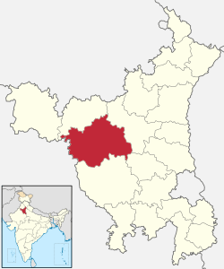 | |
| Education | ||
| Economy | ||
| Transport | ||
| Lok Sabha constituencies | ||