U.S. Route 97 in California
| ||||
|---|---|---|---|---|
|
US 97 highlighted in red | ||||
| Route information | ||||
| Defined by Streets and Highways Code § 397 | ||||
| Maintained by Caltrans | ||||
| Length | 54.364 mi[1] (87.490 km) | |||
| Existed | 1930s–present | |||
| Major junctions | ||||
| South end |
| |||
|
| ||||
| North end |
| |||
| Location | ||||
| Counties | Siskiyou | |||
| Highway system | ||||
| ||||
.svg.png)
In the U.S. state of California, U.S. Route 97 (US 97) runs north from I-5 in Weed to the Oregon state line. This is the majority of a shortcut between I-5 and Klamath Falls, Oregon, added to both states' state highway systems in 1931.
Route description
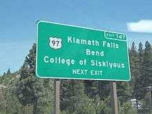
US 97 begins in Weed at an interchange with Interstate 5. It runs on Weed's Business Loop of Interstate 5, which all of the loop used to be U.S. Route 99. At the junction with California State Route 265, U.S. Route 97 ends its concurrency with the Business Loop and turns right, heading to the northeast into the Shasta-Trinity National Forest, and later the Klamath National Forest. US 97 passes by Grass Lake as it travels through the mountains before descending into the community of Macdoel. The route continues into the city of Dorris before intersecting with California State Route 161 near Indian Tom Lake before it crosses Oregon state border and leaves California.[2]
US 97 is part of the California Freeway and Expressway System,[3] and is part of the National Highway System,[4] a network of highways that are considered essential to the country's economy, defense, and mobility by the Federal Highway Administration.[5] US 97 is eligible for the State Scenic Highway System,[6] but it is not officially designated as a scenic highway by the California Department of Transportation.[7] As of 2007, it is part of the Volcanic Legacy Scenic Byway.
Major intersections
Except where prefixed with a letter, postmiles were measured on the road as it was in 1964, based on the alignment that existed at the time, and do not necessarily reflect current mileage. R reflects a realignment in the route since then, M indicates a second realignment, L refers an overlap due to a correction or change, and T indicates postmiles classified as temporary (for a full list of prefixes, see the list of postmile definitions).[1] Segments that remain unconstructed or have been relinquished to local control may be omitted. The entire route is in Siskiyou County.
| Location | Postmile [1][8][9] | Destinations | Notes | ||
|---|---|---|---|---|---|
| Weed | L0.00 | Continuation beyond I-5 | |||
| L0.00 | Interchange; south end of I-5 Bus. overlap; south end of US 97; I-5 exit 747 | ||||
| L0.43 0.05 | North end of I-5 Bus. overlap; former US 99 north | ||||
| | 4.43 | ||||
| | | ||||
| | 21.80 | Grass Lake Rest Area | |||
| | 49.90 | Agricultural Inspection Station (southbound only) | |||
| Dorris | 50.89 | First Street, Main Street | |||
| | 53.81 | ||||
| | 54.09 | Continuation into Oregon | |||
1.000 mi = 1.609 km; 1.000 km = 0.621 mi
| |||||
See also

References
- 1 2 3 California Department of Transportation. "State Truck Route List". Sacramento: California Department of Transportation. Archived from the original (XLS file) on June 30, 2015. Retrieved June 30, 2015.
- ↑ California Road Atlas (Map). Thomas Brothers. 2008.
- ↑ California State Legislature. "Section 250–257". Streets and Highways Code. Sacramento: California State Legislature. Retrieved June 9, 2017.
- ↑ Federal Highway Administration (March 25, 2015). National Highway System: California (North) (PDF) (Map). Scale not given. Washington, DC: Federal Highway Administration. Retrieved October 7, 2017.
- ↑ Natzke, Stefan; Neathery, Mike & Adderly, Kevin (June 20, 2012). "What is the National Highway System?". National Highway System. Washington, DC: Federal Highway Administration. Retrieved July 1, 2012.
- ↑ California State Legislature. "Section 260–284". Streets and Highways Code. Sacramento: California State Legislature. Retrieved June 9, 2017.
- ↑ California Department of Transportation (September 7, 2011). "Officially Designated State Scenic Highways and Historic Parkways". Sacramento: California Department of Transportation. Retrieved October 7, 2017.
- ↑ California Department of Transportation (July 2007). "Log of Bridges on State Highways". Sacramento: California Department of Transportation.
- ↑ California Department of Transportation, All Traffic Volumes on CSHS, 2005 and 2006
External links
Route map:
| Wikimedia Commons has media related to U.S. Route 97 in California. |
- California @ AARoads.com - U.S. Route 97
- Caltrans: Route 97 highway conditions
- California Highways: US 97
| Previous state: Terminus |
California | Next state: Oregon |