California State Route 265
| ||||
|---|---|---|---|---|
|
Weed Boulevard | ||||
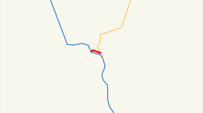 SR 265 highlighted in red | ||||
| Route information | ||||
| Defined by Streets and Highways Code § 565 | ||||
| Maintained by Caltrans | ||||
| Length | 0.527 mi[1] (0.848 km) | |||
| Major junctions | ||||
| South end |
| |||
| North end |
| |||
| Location | ||||
| Counties | Siskiyou | |||
| Highway system | ||||
| ||||


State Route 265 (SR 265), part of Weed Boulevard, is a state highway in the U.S. state of California in Siskiyou County.
Route description
The route spurs out of U.S. Route 97 in Weed while carrying Business Loop 5 from that intersection to Interstate 5. It was once part of U.S. Route 99. At a distance of 0.7 miles (1.1 km), it is the second shortest signed California state highway (after California State Route 153 in Coloma). For many years the route was hidden, but was signed in 2005 in anticipation of a complete redesign - reconstruction of Weed Boulevard. Previously, the only visual proof of the route was the bridge ID that was spraypainted on the base of the Interstate 5 overpass, i.e. "265 overcrossing".
SR 265 is not part of the National Highway System,[2] a network of highways that are considered essential to the country's economy, defense, and mobility by the Federal Highway Administration.[3]
Major intersections
Except where prefixed with a letter, postmiles were measured on the road as it was in 1964, based on the alignment of U.S. Route 99 as it existed at that time, and do not necessarily reflect current mileage. R reflects a realignment in the route since then, M indicates a second realignment, L refers an overlap due to a correction or change, and T indicates postmiles classified as temporary (for a full list of prefixes, see the list of postmile definitions).[1] Segments that remain unconstructed or have been relinquished to local control may be omitted. The entire route is in Weed, Siskiyou County.
| Postmile [1][4][5] | Destinations | Notes | |||
|---|---|---|---|---|---|
| 19.80 | South end of I-5 Bus. overlap; south end of SR 265; former US 99 south | ||||
| 20.33 | Interchange; north end of I-5 Bus. overlap; north end of SR 265; I-5 exit 748 | ||||
1.000 mi = 1.609 km; 1.000 km = 0.621 mi
| |||||
See also
See also

References
- 1 2 3 California Department of Transportation. "State Truck Route List". Sacramento: California Department of Transportation. Archived from the original (XLS file) on June 30, 2015. Retrieved June 30, 2015.
- ↑ Federal Highway Administration (March 25, 2015). National Highway System: California (North) (PDF) (Map). Scale not given. Washington, DC: Federal Highway Administration. Retrieved September 3, 2017.
- ↑ Natzke, Stefan; Neathery, Mike & Adderly, Kevin (June 20, 2012). "What is the National Highway System?". National Highway System. Washington, DC: Federal Highway Administration. Retrieved July 1, 2012.
- ↑ California Department of Transportation (July 2007). "Log of Bridges on State Highways". Sacramento: California Department of Transportation.
- ↑ California Department of Transportation, All Traffic Volumes on CSHS, 2005 and 2006
External links
Route map:
| Wikimedia Commons has media related to California State Route 265. |