Tüp
| Tüp Түп | |
|---|---|
 Tüp | |
| Coordinates: 42°43′48″N 78°21′36″E / 42.73000°N 78.36000°ECoordinates: 42°43′48″N 78°21′36″E / 42.73000°N 78.36000°E | |
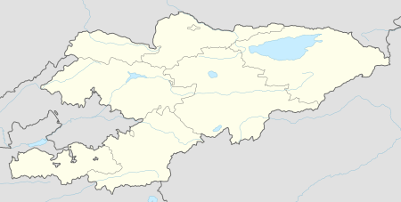
| Country | Kyrgyzstan |
| Region | Issyk-Kul Region |
| District | Tüp District |
| Preobrazhenskoye | 1870 |
| Population (2009)[1] | |
| • Total | 9,828 |
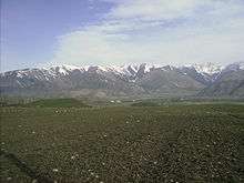
Tüp (Kyrgyz: Түп) or Tyup (Russian: Тюп) is a large village in the Issyk-Kul Region of Kyrgyzstan, and the center of the Tüp District. It was established as village Preobrazhenskoye in 1870.[2] Its population was 9,828 in 2009.[1] Tüp is a road junction town at the northeast corner of Lake Issyk Kul. To the west on A363 is Anan'yevo and to the south Karakol. To the east, A362 leads up the Karkara valley to Kazakhstan.
The Karkara ('black crane') Valley leads east from here about 60 km to Kazakhstan between the Kyungey Ala-Too to the north and the Central Tian Shan to the south. There is an annual horse festival. Halfway up the valley is the village of San-Tash (counting stones). It is said that Tamerlane once ordered each of his soldiers to place a stone in a pile as they passed. When they returned, each soldier was to remove a stone, the number of remaining stones being the number of soldiers that has died. There is a small hollow in the top of the pile, representing the comparatively very small number of people who returned. There are no other stones in the region for miles around.
Sources
- World Gazetteer: Kyrgyzstan – World-Gazetteer.com
References
- 1 2 "2009 population census of the Kyrgyz Republic: Issyk-Kul Region" (PDF). Archived from the original (PDF) on 10 August 2011. Retrieved 2011-08-10.
- ↑ Иссык-Куль. Нарын:Энциклопедия [Encyclopedia of Issyk-Kul and Naryn Oblasts] (in Russian). Bishkek: Chief Editorial Board of Kyrgyz Soviet Encyclopedia. 1994. p. 512. ISBN 5-89750-009-6.
External links