Tyrone Township, Franklin County, Illinois
| Tyrone Township | |
|---|---|
| Township | |
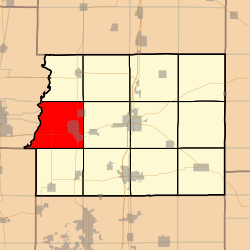 Location in Franklin County | |
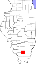 Franklin County's location in Illinois | |
| Coordinates: 37°59′34″N 89°05′34″W / 37.99278°N 89.09278°WCoordinates: 37°59′34″N 89°05′34″W / 37.99278°N 89.09278°W | |
| Country | United States |
| State | Illinois |
| County | Franklin |
| Established | November 4, 1884 |
| Area | |
| • Total | 35.81 sq mi (92.7 km2) |
| • Land | 35.39 sq mi (91.7 km2) |
| • Water | 0.42 sq mi (1.1 km2) 1.17% |
| Elevation | 469 ft (143 m) |
| Population (2010) | |
| • Estimate (2016)[1] | 4,968 |
| • Density | 131.5/sq mi (50.8/km2) |
| Time zone | UTC-6 (CST) |
| • Summer (DST) | UTC-5 (CDT) |
| ZIP codes | 62812, 62822, 62825, 62865, 62891, 62983 |
| FIPS code | 17-055-76576 |
Tyrone Township is one of twelve townships in Franklin County, Illinois, USA. As of the 2010 census, its population was 4,653 and it contained 2,202 housing units.[2]
Geography
According to the 2010 census, the township has a total area of 35.81 square miles (92.7 km2), of which 35.39 square miles (91.7 km2) (or 98.83%) is land and 0.42 square miles (1.1 km2) (or 1.17%) is water.[2]
Cities, towns, villages
- Christopher (vast majority)
- North City
- Valier (west three-quarters)
Unincorporated towns
- Mulkeytown
- Urbain, Illinois|Urbain
(This list is based on USGS data and may include former settlements.)
Cemeteries
The township contains these seven cemeteries: Cook, Greenwood, Mulkeytown, Naylor, Old Mulkeytown, Reed and Ward.
Major highways
Rivers
Lakes
- Christopher Lake
- Izaac Walton Lake
Demographics
| Historical population | |||
|---|---|---|---|
| Census | Pop. | %± | |
| Est. 2016 | 4,968 | [1] | |
| U.S. Decennial Census[3] | |||
School districts
Political districts
- Illinois' 12th congressional district
- State House District 117
- State Senate District 59
Historical Information
According to "The Heritage of Franklin County Illinois" by Susie M. Ramsey and Flossie P. Miller (1964), "Tyrone Township was named after an old steamboat. The first land entries were made by Levi Silkwood and John Kirkpatrick in 1831, and John Mulkey in 1833." (Pg. 16, 1993 Print Shop reprint edition)
References
- "Tyrone Township, Franklin County, Illinois". Geographic Names Information System. United States Geological Survey. Retrieved 2010-01-16.
- United States Census Bureau 2007 TIGER/Line Shapefiles
- United States National Atlas
- 1 2 "Population and Housing Unit Estimates". Retrieved June 9, 2017.
- 1 2 "Population, Housing Units, Area, and Density: 2010 - County -- County Subdivision and Place -- 2010 Census Summary File 1". United States Census. Retrieved 2013-05-28.
- ↑ "Census of Population and Housing". Census.gov. Retrieved June 4, 2016.
- Ramsey, Susie M. and Flossie P. Miller. "The Heritage of Franklin County Illinois". (1964, Benton Evening News).
External links
Places adjacent to Tyrone Township, Franklin County, Illinois | |
|---|---|
Municipalities and communities of Franklin County, Illinois, United States | ||
|---|---|---|
| Cities | ||
| Villages | ||
| Townships | ||
| CDP | ||
| Other unincorporated communities | ||
| Footnotes | ‡This populated place also has portions in an adjacent county or counties | |