Browning Township, Franklin County, Illinois
| Browning Township | |
|---|---|
| Township | |
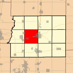 Location in Franklin County | |
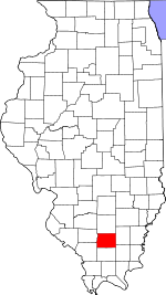 Franklin County's location in Illinois | |
| Coordinates: 37°59′25″N 88°58′58″W / 37.99028°N 88.98278°WCoordinates: 37°59′25″N 88°58′58″W / 37.99028°N 88.98278°W | |
| Country | United States |
| State | Illinois |
| County | Franklin |
| Established | November 4, 1884 |
| Area | |
| • Total | 36.48 sq mi (94.5 km2) |
| • Land | 35.79 sq mi (92.7 km2) |
| • Water | 0.69 sq mi (1.8 km2) 1.89% |
| Elevation | 381 ft (116 m) |
| Population (2010) | |
| • Estimate (2016)[1] | 2,396 |
| • Density | 68.5/sq mi (26.4/km2) |
| Time zone | UTC-6 (CST) |
| • Summer (DST) | UTC-5 (CDT) |
| ZIP codes | 62812, 62819, 62822, 62865, 62884, 62891 |
| FIPS code | 17-055-08940 |
Browning Township is one of twelve townships in Franklin County, Illinois, USA. As of the 2010 census, its population was 2,450 and it contained 1,184 housing units.[2]
Geography
According to the 2010 census, the township has a total area of 36.48 square miles (94.5 km2), of which 35.79 square miles (92.7 km2) (or 98.11%) is land and 0.69 square miles (1.8 km2) (or 1.89%) is water.[2]
Cities, towns, villages
- Benton (west quarter)
- Buckner
- Christopher (east edge)
- Valier (east quarter)
- West City
Unincorporated towns
Rend City
Extinct towns
- Hickory Corners
Cemeteries
The township contains eleven cemeteries. These are: Browning, Grammer, Harrison, Hickory Corners, Knight, Moser, Mount Pleasant, Saint Joseph, Saint Marys, Smith and Wayman.
Major highways
Airports and landing strips
- Benton Municipal Airport
Landmarks
- Benton City Park
Demographics
| Historical population | |||
|---|---|---|---|
| Census | Pop. | %± | |
| Est. 2016 | 2,396 | [1] | |
| U.S. Decennial Census[3] | |||
School districts
- Christopher Community Unit School District 99
- Sesser-Valier Community Unit School District 196
Political districts
- Illinois' 12th congressional district
- State House District 117
- State Senate District 59
References
- "Browning Township, Franklin County, Illinois". Geographic Names Information System. United States Geological Survey. Retrieved 2010-01-16.
- United States Census Bureau 2007 TIGER/Line Shapefiles
- United States National Atlas
- 1 2 "Population and Housing Unit Estimates". Retrieved June 9, 2017.
- 1 2 "Population, Housing Units, Area, and Density: 2010 - County -- County Subdivision and Place -- 2010 Census Summary File 1". United States Census. Retrieved 2013-05-28.
- ↑ "Census of Population and Housing". Census.gov. Retrieved June 4, 2016.
External links
Places adjacent to Browning Township, Franklin County, Illinois | |
|---|---|
Municipalities and communities of Franklin County, Illinois, United States | ||
|---|---|---|
| Cities | ||
| Villages | ||
| Townships | ||
| CDP | ||
| Other unincorporated communities | ||
| Footnotes | ‡This populated place also has portions in an adjacent county or counties | |
This article is issued from
Wikipedia.
The text is licensed under Creative Commons - Attribution - Sharealike.
Additional terms may apply for the media files.