Tyendinaga, Ontario
| Tyendinaga | |
|---|---|
| Township (lower-tier) | |
| Township of Tyendinaga | |
 Marysville | |
 Tyendinaga | |
| Coordinates: 44°18′N 77°12′W / 44.300°N 77.200°WCoordinates: 44°18′N 77°12′W / 44.300°N 77.200°W | |
| Country |
|
| Province |
|
| County | Hastings |
| Incorporated | 1820 |
| Government | |
| • Type | Township |
| • Reeve | Rick Phillips |
| • Federal riding | Hastings—Lennox and Addington |
| • Prov. riding | Prince Edward—Hastings |
| Area[1] | |
| • Land | 313.00 km2 (120.85 sq mi) |
| Population (2011)[1] | |
| • Total | 4,150 |
| • Density | 13.3/km2 (34/sq mi) |
| Time zone | UTC-5 (EST) |
| • Summer (DST) | UTC-4 (EDT) |
| Postal Code | K0K |
| Area code(s) | 613 |
| Website |
www.tyendinagatownship .com |
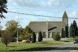
Tyendinaga is a township in the Canadian province of Ontario, located in Hastings County. The community takes its name from a variant spelling of Mohawk leader Joseph Brant's traditional Mohawk name, Thayendanegea.
Communities
The township comprises the communities of Albert, Blessington, Chisholms Mills, Ebenezer, Halston, Kingsford, Lonsdale, Lonsdale Station, Melrose, Marysville, Milltown, Myrehall, Naphan, Read and Shannonville.
Demographics
| Canada census – Tyendinaga, Ontario community profile | |||
|---|---|---|---|
| 2011 | 2006 | ||
| Population: | 4150 (2.0% from 2006) | 4070 (8.0% from 2001) | |
| Land area: | 313.00 km2 (120.85 sq mi) | 311.94 km2 (120.44 sq mi) | |
| Population density: | 13.3/km2 (34/sq mi) | 13.0/km2 (34/sq mi) | |
| Median age: | 37.2 (M: 37.1, F: 37.4) | ||
| Total private dwellings: | 1547 | 1445 | |
| Median household income: | $63,254 | ||
| References: 2011[2] 2006[3] earlier[4] | |||
Population trend:[5]
- Population in 2011: 4150
- Population in 2006: 4070
- Population in 2001: 3769
- Population in 1996: 3549
- Population in 1991: 3118
Mother tongue:[6]
- English as first language: 96.0%
- French as first language: 0.7%
- English and French as first language: 0%
- Other as first language: 3.3%
See also
References
- 1 2 "Tyendinaga census profile". 2011 Census of Population. Statistics Canada. Retrieved 2012-03-02.
- ↑ "2011 Community Profiles". Canada 2011 Census. Statistics Canada. July 5, 2013. Retrieved 2012-03-02.
- ↑ "2006 Community Profiles". Canada 2006 Census. Statistics Canada. March 30, 2011. Retrieved 2012-03-02.
- ↑ "2001 Community Profiles". Canada 2001 Census. Statistics Canada. February 17, 2012.
- ↑ Statistics Canada: 1996, 2001, 2006 census
- ↑ "Clearview, Ontario (Code3543005) (table)". 2006 Census data. Statistics Canada. Retrieved 2010-12-15.
External links
Places adjacent to Tyendinaga, Ontario | |
|---|---|
| Cities | 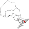 | |
|---|---|---|
| Towns | ||
| Townships | ||
| First Nations | ||
| Indian reserves | ||
| ||
This article is issued from
Wikipedia.
The text is licensed under Creative Commons - Attribution - Sharealike.
Additional terms may apply for the media files.